
Datoteka:Gordon Dam.jpg

Veličina ovog prikaza: 394 × 599 piksela. Ostale rezolucije: 158 × 240 piksela | 315 × 480 piksela | 505 × 768 piksela | 673 × 1.024 piksela | 2.552 × 3.882 piksela.
Izvorna datoteka (2.552 × 3.882 piksela, veličina datoteke: 13,21 MB, MIME tip: image/jpeg)
| Ova datoteka je s Wikimedia Commonsa. Opis s njene stranice opisa datoteke prikazan je ispod. Commons je skladište slobodnih medija i datoteka za sve projekte fondacije Wikimedia. Možete i Vi pomoći. |
Sažetak
| Opis |
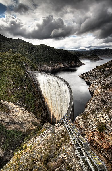
English: Gordon Dam, Southwest National Park, Tasmania, Australia.
Français : Le barrage de Gordon, dans la Parc National du Sud-Ouest, en Tasmanie (Australie).
Русский: Плотина Гордон на реке Гордон в Южном Национальном парке штата Тасмания, Австралия.
العربية: سد غوردون، في جنوب غرب الحديقة الوطنية، في تسمانيا، استراليا. |
||
| Datum | |||
| Izvor | Vlastito djelo | ||
| Autor | JJ Harrison | ||
| Dopuštenje (Naknadno korištenje ove datoteke) |
Ja, vlasnik autorskog prava ovog djela, ovdje ga objavljujem pod sljedećim licencama: Ova datoteka je licencirana pod Creative Commons Attribution-Share Alike 3.0 neportiranom licencom.
Možete odabrati licencu po vašem izboru. |

| Object location | | View this and other nearby images on: OpenStreetMap |
|---|
| Camera location | | View this and other nearby images on: OpenStreetMap |
|---|
| Camera Model | Canon EOS 400D |
|---|---|
| Shutter speed | 1/100 s, 1/400 s, 1/1600 s |
| Aperture | f/4 |
| Film speed (ISO) | 100 |
| Lens | Sigma 10-20mm f/4-5.6 EX DC HSM |
| Focal length | 10 |
|

This image was selected as picture of the day on Wikimedia Commons for 14 December 2008. It was captioned as follows: English: Gordon Dam, Southwest National Park, Tasmania, Australia Other languages:
Afrikaans: Gordondam in Southwest Nasionale Park, Tasmanië Deutsch: Die Gordon-Staumauer, eine Talsperre mit Bogenstaumauer auf der Australien vorgelagerten Insel Tasmanien English: Gordon Dam, Southwest National Park, Tasmania, Australia Italiano: Diga Gordon, a sudovest del "National Park" situato in Tasmania (Australia) Українська: Гребля на водосховищі Ґордон (Gordon Dam), Південно-Західний Національний парк (Southwest National Park), о. Тасманія, Австралія. 中文: 澳大利亚西南国家公园戈登坝 中文(繁體): 澳洲西南國家公園戈登壩 |
This image was selected as picture of the day on Vietnamese Wikipedia.
|
|
Deutsch: Dieses Bild war 2010 in der 2. Kalenderwoche das Bild der Woche in der Malaysischen Wikipedia
English: This image was selected as a picture of the week on the Malay Wikipedia for the 2nd week, 2010.
Македонски: Сликава е избрана за слика на неделата на малајската Википедија за II недела од 2010 година.
Bahasa Melayu: Imej ini merupakan gambar pilihan mingguan di Wikipedia Bahasa Melayu untuk minggu ke-2, 2010.
Français : Cette image est sélectionnée en tant qu'image de la semaine sur la Wikipédia Malaisienne pour la 2ème semaine de 2010.
Italiano: Questa immagine è stata selezionata come Immagine della settimana su Wikipedia in malese per la II settimana del 2010.
Nederlands: Deze afbeelding is gekozen als afbeelding van de week op de Maleisische Wikipedia voor week 2 van 2010.
Русский: Эта иллюстрация была выбрана изображением недели в малайском разделе «Википедии» для недели номер 2 2010 года.
Українська: Ця ілюстрація була вибрана зображенням тижня в малайському розділі «Вікіпедії» для тижня номер 2, 2010 року.
Tiếng Việt: Hình này đã được chọn làm hình ảnh của tuần trên Wikipedia tiếng Mã Lai trong tuần thứ 2, năm 2010.
|
| This is a retouched picture, which means that it has been digitally altered from its original version. Modifications: HDR from three exposure bracketed shots.
|
Historija datoteke
Kliknite na datum/vrijeme da vidite verziju datoteke iz tog vremena.
| Datum/vrijeme | Smanjeni pregled | Dimenzije | Korisnik | Komentar | |
|---|---|---|---|---|---|
| trenutno | 12:08, 2 mart 2019 | | 2.552 × 3.882 (13,21 MB) | JJ Harrison | more pixels |
| 13:30, 25 septembar 2008 |  | 1.276 × 1.941 (1,89 MB) | JJ Harrison | {{Information |Description= |Source= |Date= |Author= |Permission= |other_versions= }} | |
| 13:19, 25 septembar 2008 |  | 1.276 × 1.941 (1,89 MB) | JJ Harrison | {{Information |Description= |Source= |Date= |Author= |Permission= |other_versions= }} | |
| 03:54, 12 septembar 2008 |  | 1.276 × 1.941 (1,97 MB) | JJ Harrison | {{Information |Description={{en|1=Gordon Dam, Southwest National Park, Tasmania}} |Source=Own work by uploader |Author=Noodle snacks |Date=10/09/08 |Permission= |other_versions= }} {{Coor dms|42|43|50.9|S|145|58|33|E}} {{Location|42 |
Upotreba datoteke
Sljedeća stranica koristi ovu datoteku:
Globalna upotreba datoteke
Sljedeći wikiji koriste ovu datoteku:
- Upotreba na af.wikipedia.org
- Upotreba na af.wiktionary.org
- Upotreba na am.wikipedia.org
- Upotreba na ar.wikipedia.org
- Upotreba na arz.wikipedia.org
- Upotreba na ba.wikipedia.org
- Upotreba na be-tarask.wikipedia.org
- Upotreba na be.wikipedia.org
- Upotreba na bg.wikipedia.org
- Upotreba na bn.wikipedia.org
- Upotreba na bxr.wikipedia.org
- Upotreba na ceb.wikipedia.org
- Upotreba na crh.wikipedia.org
- Upotreba na cv.wikipedia.org
- Upotreba na de.wikipedia.org
- Bogenstaumauer
- Lake Gordon (Australien)
- Wikipedia:Exzellente Bilder/Technik und Verkehr
- Wikipedia:Kandidaten für exzellente Bilder/Archiv2008/26
- Datei:Gordon Dam.jpg
- Wikipedia:Diskussionen über Bilder/Archiv/2009/Jun
- Benutzer:Raf-dat/Schönste Bilder/3
- Portal:Energie/Exzellente Bilder zum Thema Energie
- Gordon River (Macquarie Harbour)
- Hydro Tasmania
- Benutzer:Gleiten/upright
- Upotreba na en.wikipedia.org
- Dam
- List of dams and reservoirs in the United Kingdom
- List of dams and reservoirs in the United States
- List of dams and reservoirs in Germany
- List of dams and reservoirs in Bulgaria
- List of dams and reservoirs in New Zealand
- List of dams and reservoirs in Romania
- List of dams and reservoirs in Canada
- Lake Gordon
- Hydro Tasmania
- Ecosystem engineer
- List of dams and reservoirs in Poland
- List of dams and reservoirs in Australia
- Lionel Murphy
- List of dams and reservoirs in India
- List of dams and reservoirs in Singapore
- Dams and reservoirs in Laos
- List of dams and reservoirs in Trinidad and Tobago
Pogledajte globalne upotrebe ove datoteke.