
Datoteka:LocationTrinidadAndTobago.png
Veća rezolucija nije dostupna.
LocationTrinidadAndTobago.png (250 × 115 piksela, veličina datoteke: 6 KB, MIME tip: image/png)
| Ova datoteka je s Wikimedia Commonsa. Opis s njene stranice opisa datoteke prikazan je ispod. Commons je skladište slobodnih medija i datoteka za sve projekte fondacije Wikimedia. Možete i Vi pomoći. |

|
This locator map image could be re-created using vector graphics as an SVG file. This has several advantages; see Commons:Media for cleanup for more information. If an SVG form of this image is available, please upload it and afterwards replace this template with
{{vector version available|new image name}}.
It is recommended to name the SVG file “LocationTrinidadAndTobago.svg”—then the template Vector version available (or Vva) does not need the new image name parameter. |
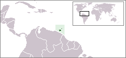
Location map for the Trinidad and Tobago.
Originally created for English Wikipedia by Vardion.
| |
Ovaj rad je objavljen u javno vlasništvo od strane autora Vardion, at the engleski Wikipedia project. Ovo se primjenjuje širom svijeta. In case this is not legally possible: |
Historija datoteke
Kliknite na datum/vrijeme da vidite verziju datoteke iz tog vremena.
| Datum/vrijeme | Smanjeni pregled | Dimenzije | Korisnik | Komentar | |
|---|---|---|---|---|---|
| trenutno | 05:12, 20 decembar 2004 | | 250 × 115 (6 KB) | EugeneZelenko | Location map for the Trinidad and Tobago.<br/>Originally created for English Wikipedia by Vardion.<br/>{{PD}}<br/>Category:Country locator maps |
Upotreba datoteke
Sljedeća stranica koristi ovu datoteku:
Globalna upotreba datoteke
Sljedeći wikiji koriste ovu datoteku:
- Upotreba na als.wikipedia.org
- Upotreba na ar.wikipedia.org
- Upotreba na ar.wikinews.org
- Upotreba na awa.wikipedia.org
- Upotreba na azb.wikipedia.org
- Upotreba na ba.wikipedia.org
- Upotreba na be-tarask.wikipedia.org
- Upotreba na be.wikipedia.org
- Upotreba na bg.wikipedia.org
- Upotreba na bo.wikipedia.org
- Upotreba na bpy.wikipedia.org
- Upotreba na da.wikipedia.org
- Upotreba na de.wikipedia.org
- Upotreba na de.wiktionary.org
- Upotreba na dsb.wikipedia.org
- Upotreba na en.wikipedia.org
- User:DanielZM/test
- Trinidad and Tobago cuisine
- Biota of Trinidad and Tobago
- List of transcontinental countries
- Area code 868
- User:TheGrappler/North America directory
- List of Trinidad and Tobago–related topics
- Talk:South America/Archive 1
- Portal:Caribbean/Selected cuisine
- Portal:Caribbean/Selected cuisine/5
- LGBT rights in Trinidad and Tobago
- Talk:North America/Archive 2
- Outline of Trinidad and Tobago
- Wikipedia:WikiProject Trinidad and Tobago/Index of Trinidad and Tobago–related articles
- Environment of Trinidad and Tobago
- Portal:Trinidad and Tobago
- Portal:Trinidad and Tobago/Intro
- Colonization attempts by Poland
- List of non-marine molluscs of Trinidad and Tobago
- List of scorpions of Trinidad and Tobago
- List of Opiliones of Trinidad and Tobago
- List of mantids of Trinidad and Tobago
- Upotreba na en.wikivoyage.org
- Upotreba na eo.wikipedia.org
- Upotreba na eo.wiktionary.org
- Upotreba na es.wikipedia.org
- Upotreba na es.wikinews.org
Pogledajte globalne upotrebe ove datoteke.