
Datoteka:Plan de Versailles - Gesamtplan von Delagrife 1746.jpg

Veličina ovog prikaza: 800 × 528 piksela. Ostale rezolucije: 320 × 211 piksela | 640 × 422 piksela | 1.024 × 676 piksela | 1.280 × 845 piksela | 2.560 × 1.690 piksela | 3.227 × 2.130 piksela.
Izvorna datoteka (3.227 × 2.130 piksela, veličina datoteke: 3,71 MB, MIME tip: image/jpeg)
| Ova datoteka je s Wikimedia Commonsa. Opis s njene stranice opisa datoteke prikazan je ispod. Commons je skladište slobodnih medija i datoteka za sve projekte fondacije Wikimedia. Možete i Vi pomoći. |
Sažetak
| Artist |
|
|||||||||||||||||||||||
| Opis |
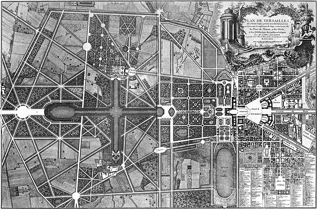
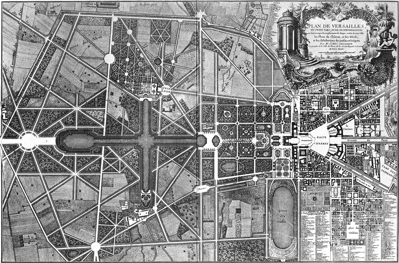
Français : "Plan de Versailles, du petit parc, et de ses dependances où sont marqués les emplacemens de chaque maison de cette ville, les plans du Château, et des hôtels, et les distributions des jardins et bosquets" par Mr l'abbé Delagrive(1689-1757) - M D CC XLVI (1746) English: Map of Versailles, by Delagrive (1689-1757), 1746. |
|||||||||||||||||||||||
| Datum | 1746 | |||||||||||||||||||||||
| Notes |
|
|||||||||||||||||||||||
| Source/Photographer | Jean Delagrive | |||||||||||||||||||||||
| Ostale verzije |
|
|||||||||||||||||||||||
,_g%C3%A9ographe_et_graveur._-_P2672_-_Mus%C3%A9e_Carnavalet.jpg)

Licenciranje
|
The author died in 1757, so this work is in the public domain in its country of origin and other countries and areas where the copyright term is the author's life plus 100 years or fewer. This work is in the public domain in the United States because it was published (or registered with the U.S. Copyright Office) before January 1, 1929. | |
| Ova datoteka je identificirana kao slobodna od poznatih ograničenja po zakonu o autorskim pravima, uključujući sva povezana i srodna prava. | |
Historija datoteke
Kliknite na datum/vrijeme da vidite verziju datoteke iz tog vremena.
| Datum/vrijeme | Smanjeni pregled | Dimenzije | Korisnik | Komentar | |
|---|---|---|---|---|---|
| trenutno | 21:11, 9 januar 2008 | | 3.227 × 2.130 (3,71 MB) | Sitacuisses | contrast enhanced |
| 16:08, 22 april 2006 |  | 3.227 × 2.130 (2,04 MB) | Greenhorn~commonswiki | Plan de Versailles, Delagrife, 1746 |
Upotreba datoteke
Sljedeća stranica koristi ovu datoteku:
Globalna upotreba datoteke
Sljedeći wikiji koriste ovu datoteku:
- Upotreba na bg.wikipedia.org
- Upotreba na cs.wikipedia.org
- Upotreba na de.wikipedia.org
- Upotreba na el.wikipedia.org
- Upotreba na en.wikipedia.org
- Upotreba na en.wikibooks.org
- Upotreba na fr.wikipedia.org
- Upotreba na he.wikipedia.org
- Upotreba na it.wikipedia.org
- Upotreba na lt.wikipedia.org
- Upotreba na nds.wikipedia.org
- Upotreba na pt.wikipedia.org
- Upotreba na sh.wikipedia.org
- Upotreba na sk.wikipedia.org
- Upotreba na sl.wikipedia.org
- Upotreba na sr.wikipedia.org
- Upotreba na www.wikidata.org