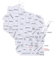
Datoteka:Wisconsin-counties-map.gif

Veličina ovog prikaza: 562 × 599 piksela. Ostale rezolucije: 225 × 240 piksela | 450 × 480 piksela | 811 × 865 piksela.
Izvorna datoteka (811 × 865 piksela, veličina datoteke: 62 KB, MIME tip: image/gif)
Historija datoteke
Kliknite na datum/vrijeme da vidite verziju datoteke iz tog vremena.
| Datum/vrijeme | Smanjeni pregled | Dimenzije | Korisnik | Komentar | |
|---|---|---|---|---|---|
| trenutno | 19:27, 22 april 2010 |  | 811 × 865 (62 KB) | W Nowicki | attempt to fix the wrong mime type so it actually displays; it was php? |
| 22:18, 20 mart 2006 | Nema smanjenog pregleda | (62 KB) | Semolo75 | SOURCE: http://www.fedstats.gov/qf/maps/stout55.gif {{PD-USGov}} |
Upotreba datoteke
Sljedeća stranica koristi ovu datoteku:
Globalna upotreba datoteke
Sljedeći wikiji koriste ovu datoteku:
- Upotreba na ar.wikipedia.org
- Upotreba na arz.wikipedia.org
- Upotreba na ca.wikipedia.org
- Upotreba na cy.wikipedia.org
- Upotreba na da.wikipedia.org
- Upotreba na en.wikipedia.org
- Upotreba na es.wikipedia.org
- Upotreba na fr.wikipedia.org
- Upotreba na he.wikipedia.org
- Upotreba na hu.wikipedia.org
- Upotreba na it.wikipedia.org
- Upotreba na ja.wikipedia.org
- Upotreba na kn.wikipedia.org
- Upotreba na ko.wikipedia.org
- Upotreba na nds.wikipedia.org
- Upotreba na nl.wikipedia.org
- Upotreba na no.wikipedia.org
- Upotreba na pam.wikipedia.org
- Upotreba na pl.wikipedia.org
- Upotreba na pt.wikipedia.org
- Upotreba na ro.wikipedia.org
- Upotreba na ru.wikipedia.org
- Upotreba na sv.wikipedia.org
- Upotreba na te.wikipedia.org
- Upotreba na ur.wikipedia.org
- Upotreba na vi.wikipedia.org
- Upotreba na zh.wikipedia.org

