
Datoteka:World in 900 CE.png

Veličina ovog prikaza: 800 × 407 piksela. Ostale rezolucije: 320 × 163 piksela | 640 × 326 piksela | 1.024 × 521 piksela | 1.280 × 652 piksela | 4.000 × 2.036 piksela.
Izvorna datoteka (4.000 × 2.036 piksela, veličina datoteke: 1,76 MB, MIME tip: image/png)
| Ova datoteka je s Wikimedia Commonsa. Opis s njene stranice opisa datoteke prikazan je ispod. Commons je skladište slobodnih medija i datoteka za sve projekte fondacije Wikimedia. Možete i Vi pomoći. |
Sažetak
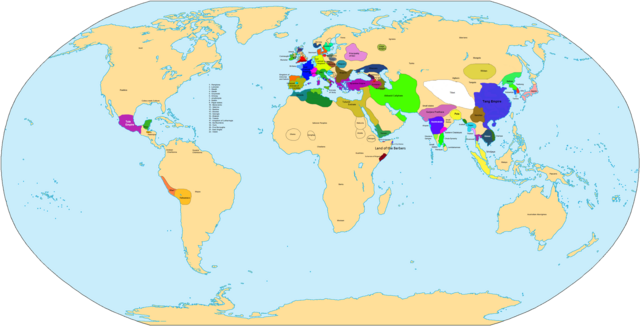
| Opis | Map of the world in 900 AD. |
| Izvor | Vlastito djelo |
| Autor | Javierfv1212 |

|
This historical map image could be re-created using vector graphics as an SVG file. This has several advantages; see Commons:Media for cleanup for more information. If an SVG form of this image is available, please upload it and afterwards replace this template with
{{vector version available|new image name}}.
It is recommended to name the SVG file “World in 900 CE.svg”—then the template Vector version available (or Vva) does not need the new image name parameter. |
| Maps of world history | |
| BC | |
|
| |
| AD |
1 · 50 · 100 · 200 · 250 · 300 · 400 · 500 · 700 · 750 · 820 · 900 · 1200 · 1500 · 1556 · 1648 · 1700 · 1750 · 1815 · 1859 · 1871 · 1914 · 1935 · 1954 · 1989 · 2000 · |
|
Maps of colonization history | |
|
see also: Eastern Hemisphere only maps template (1300BC-1500AD) | |
| (this template: · view · discuss ) | |
.jpg)
._LOC_2001620596.jpg)
Licenciranje
| Ja, vlasnik autorskog prava ovog djela, objavljujem ovaj rad u javno vlasništvo. Ovo se primjenjuje u cijelom svijetu. U nekim državama ovo zakonski nije moguće; u tom slučaju: Ja dopuštam svima pravo korištenja ovog rada u bilo koju svrhu, bez ikakvih uslova, osim ako su takvi uslovi zakonski neophodni. |
Historija datoteke
Kliknite na datum/vrijeme da vidite verziju datoteke iz tog vremena.
| Datum/vrijeme | Smanjeni pregled | Dimenzije | Korisnik | Komentar | |
|---|---|---|---|---|---|
| trenutno | 11:32, 3 april 2021 | | 4.000 × 2.036 (1,76 MB) | Glennznl | Reverted to version as of 23:14, 31 October 2020 (UTC) Completely unsourced, the Igorot society article has been deleted from Wikipedia as it is a hoax |
| 04:54, 27 mart 2021 |  | 4.000 × 2.036 (1,57 MB) | Enola gay0 | Reverted to version as of 09:48, 29 May 2019 (UTC) tondo-LCI | |
| 01:14, 1 novembar 2020 |  | 4.000 × 2.036 (1,76 MB) | Glennznl | Reverted to version as of 18:02, 5 July 2015 (UTC) | |
| 11:48, 29 maj 2019 |  | 4.000 × 2.036 (1,57 MB) | Enola gay0 | ||
| 07:20, 7 decembar 2017 |  | 4.000 × 2.036 (1,76 MB) | Gunkarta | Reverted to version as of 18:02, 5 July 2015 (UTC) false pseudohistory | |
| 14:39, 2 juni 2017 |  | 4.000 × 2.036 (1,57 MB) | Theseeker2016 | Tondo, Tundun or Lusung <ref>{{cite book|author=Keat Gin Ooi|title=Southeast Asia: A Historical Encyclopedia, from Angkor Wat to East Timor|url=https://books.google.com/books?id=QKgraWbb7yoC|year=2004|publisher=ABC-CLIO|isbn=978-1-57607-770-2|page=[htt... | |
| 20:02, 5 juli 2015 |  | 4.000 × 2.036 (1,76 MB) | BartekChom | Veleti and Czechs did not live on territory of modern Poland, for example File:Europe around 900.jpg | |
| 17:47, 10 januar 2013 |  | 4.000 × 2.036 (1,95 MB) | Runehelmet | Updated | |
| 19:20, 20 mart 2009 |  | 4.000 × 2.036 (1,79 MB) | Huhsunqu | wari instead moche | |
| 03:50, 4 novembar 2007 |  | 4.000 × 2.036 (1,8 MB) | Javierfv1212 | {{Information |Description= |Source=self-made |Date= |Author= Javierfv1212 |Permission= |other_versions= }} Category:Maps of the world showing history |
Upotreba datoteke
Sljedeća stranica koristi ovu datoteku:
Globalna upotreba datoteke
Sljedeći wikiji koriste ovu datoteku:
- Upotreba na de.wikipedia.org
- Upotreba na el.wikipedia.org
- Upotreba na en.wikipedia.org
- Upotreba na es.wikipedia.org
- Upotreba na fr.wikipedia.org
- Upotreba na he.wikipedia.org
- Upotreba na ka.wikipedia.org
- Upotreba na lt.wikipedia.org
- Upotreba na nl.wikipedia.org
- Upotreba na ru.wikipedia.org
- Upotreba na sv.wikipedia.org
- Upotreba na tt.wikipedia.org
- Upotreba na uk.wikipedia.org
- Upotreba na zh.wikipedia.org