
Datoteka:Dnieper 32.03650E 46.60888N.jpg

Veličina ovog prikaza: 800 × 599 piksela. Ostale rezolucije: 320 × 240 piksela | 640 × 479 piksela | 1.024 × 766 piksela | 1.280 × 958 piksela.
Izvorna datoteka (1.280 × 958 piksela, veličina datoteke: 245 KB, MIME tip: image/jpeg)
| Ova datoteka je s Wikimedia Commonsa. Opis s njene stranice opisa datoteke prikazan je ispod. Commons je skladište slobodnih medija i datoteka za sve projekte fondacije Wikimedia. Možete i Vi pomoći. |
Sažetak
| Opis |
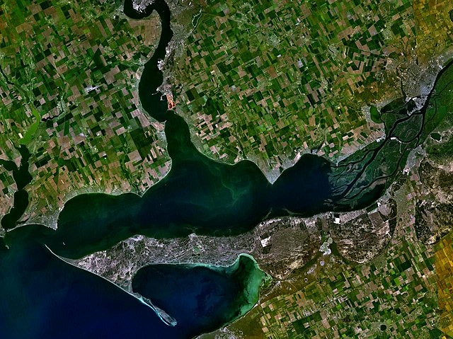
English: The satellite view of the Dnieper-Bug Estuary and the Dnieper delta. |
| Datum | Nepoznat datum |
| Izvor | Satellite imagery taken from NASA World Wind software (by screenshot) |
| Autor | World Wind |
| Object location | | View this and other nearby images on: OpenStreetMap |
|---|
Licenciranje
| This image is in the public domain because it is a screenshot from NASA’s globe software World Wind using a public domain layer, such as Blue Marble, MODIS, Landsat, SRTM, USGS or GLOBE.
|
 |
Historija datoteke
Kliknite na datum/vrijeme da vidite verziju datoteke iz tog vremena.
| Datum/vrijeme | Smanjeni pregled | Dimenzije | Korisnik | Komentar | |
|---|---|---|---|---|---|
| trenutno | 20:48, 22 juni 2005 | | 1.280 × 958 (245 KB) | Rex | Dnieper river {{World Wind}} Category:Rivers |
Upotreba datoteke
Sljedeća stranica koristi ovu datoteku:
Globalna upotreba datoteke
Sljedeći wikiji koriste ovu datoteku:
- Upotreba na ar.wikipedia.org
- Upotreba na ast.wikipedia.org
- Upotreba na be.wikipedia.org
- Upotreba na ca.wikipedia.org
- Upotreba na cy.wikipedia.org
- Upotreba na da.wikipedia.org
- Upotreba na de.wikipedia.org
- Upotreba na en.wikipedia.org
- Upotreba na es.wikipedia.org
- Upotreba na fi.wikipedia.org
- Upotreba na fr.wikipedia.org
- Upotreba na fy.wikipedia.org
- Upotreba na hr.wikipedia.org
- Upotreba na hu.wikipedia.org
- Upotreba na it.wikipedia.org
- Upotreba na ja.wikipedia.org
- Upotreba na ka.wikipedia.org
- Upotreba na kbd.wikipedia.org
- Upotreba na lt.wikipedia.org
- Upotreba na mk.wikipedia.org
- Upotreba na nl.wikipedia.org
- Upotreba na nn.wikipedia.org
- Upotreba na no.wikipedia.org
- Upotreba na pl.wikipedia.org
- Upotreba na pt.wikipedia.org
- Upotreba na ru.wikipedia.org
- Upotreba na sh.wikipedia.org
- Upotreba na sl.wikipedia.org
- Upotreba na sr.wikipedia.org
Pogledajte globalne upotrebe ove datoteke.