
Datoteka:Geographic Map of Mexico.jpg
Veličina ovog prikaza: 800 × 564 piksela. Ostale rezolucije: 320 × 226 piksela | 640 × 451 piksela | 1.024 × 722 piksela.
Izvorna datoteka (1.024 × 722 piksela, veličina datoteke: 455 KB, MIME tip: image/jpeg)
| Ova datoteka je s Wikimedia Commonsa. Opis s njene stranice opisa datoteke prikazan je ispod. Commons je skladište slobodnih medija i datoteka za sve projekte fondacije Wikimedia. Možete i Vi pomoći. |
Sažetak
| Opis |
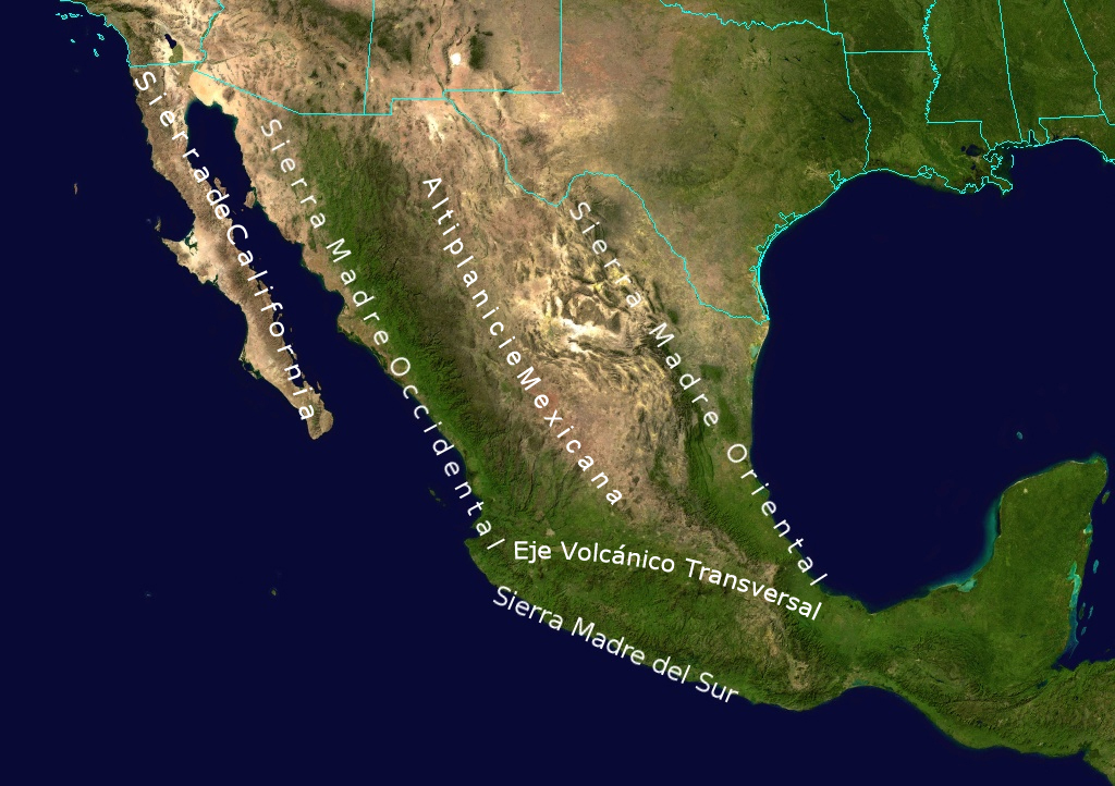
English: Topological Map labeling the most important elevations of the country |
| Datum | |
| Izvor | NASA |
| Autor | NASA - derivative work by Ricraider |
Licenciranje
| This file is in the public domain in the United States because it was solely created by NASA. NASA copyright policy states that "NASA material is not protected by copyright unless noted". (See Template:PD-USGov, NASA copyright policy page or JPL Image Use Policy.) | ||
 |
Warnings:
|
Originalni zapisnik postavljanja
The original description page was here. All following user names refer to en.wikipedia.
- 2010-08-24 02:05 Ricraider 1024×722× (465741 bytes) {{Information |Description = Topological Map labeling the most important elevations of the country |Source = NASA |Date = 8-23-10 |Author = ricraider |Permission = |other_versions = }}
Historija datoteke
Kliknite na datum/vrijeme da vidite verziju datoteke iz tog vremena.
| Datum/vrijeme | Smanjeni pregled | Dimenzije | Korisnik | Komentar | |
|---|---|---|---|---|---|
| trenutno | 11:02, 21 decembar 2012 | | 1.024 × 722 (455 KB) | Urdangaray | {{Information |Description={{en|Topological Map labeling the most important elevations of the country}} |Source=Transferred from [http://en.wikipedia.org en.wikipedia]<br/> (Original text : ''NASA'') |Date=8-23-10<br/> ({{Original upload date|2010-08-2... |
Upotreba datoteke
Sljedeća stranica koristi ovu datoteku:
Globalna upotreba datoteke
Sljedeći wikiji koriste ovu datoteku:
- Upotreba na cs.wikipedia.org
- Upotreba na de.wikipedia.org
- Upotreba na en.wikipedia.org
- Upotreba na es.wikipedia.org
- Upotreba na eu.wikipedia.org
- Upotreba na fa.wikipedia.org
- Upotreba na is.wikipedia.org
- Upotreba na ja.wikipedia.org
- Upotreba na nn.wikipedia.org
- Upotreba na no.wikipedia.org
- Upotreba na pl.wikipedia.org
- Upotreba na simple.wikipedia.org
- Upotreba na sk.wikipedia.org
- Upotreba na sv.wikipedia.org
- Upotreba na tr.wikipedia.org
- Upotreba na uk.wikipedia.org
- Upotreba na zh.wikipedia.org