
Datoteka:Jomann Imperium Periscum.jpg

Veličina ovog prikaza: 703 × 600 piksela. Ostale rezolucije: 281 × 240 piksela | 563 × 480 piksela | 900 × 768 piksela | 1.200 × 1.024 piksela | 1.992 × 1.700 piksela.
Izvorna datoteka (1.992 × 1.700 piksela, veličina datoteke: 2,18 MB, MIME tip: image/jpeg)
| Ova datoteka je s Wikimedia Commonsa. Opis s njene stranice opisa datoteke prikazan je ispod. Commons je skladište slobodnih medija i datoteka za sve projekte fondacije Wikimedia. Možete i Vi pomoći. |
Sažetak
| Opis |
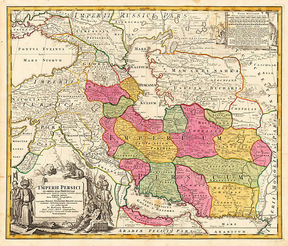
English: Map of Persia Copperplate print on paper, colorized, 53 × 60.7 cm |
|||||||||||||||||||||||
| Datum | circa 1700 - circa 1720 | |||||||||||||||||||||||
| Izvor | www.lot-tissimo.net | |||||||||||||||||||||||
| Autor |
|
|||||||||||||||||||||||
| Ostale verzije | ||||||||||||||||||||||||
.jpg)


Licenciranje
|
This is a faithful photographic reproduction of a two-dimensional, public domain work of art. The work of art itself is in the public domain for the following reason:
The official position taken by the Wikimedia Foundation is that "faithful reproductions of two-dimensional public domain works of art are public domain".
This photographic reproduction is therefore also considered to be in the public domain in the United States. In other jurisdictions, re-use of this content may be restricted; see Reuse of PD-Art photographs for details. | ||||
Historija datoteke
Kliknite na datum/vrijeme da vidite verziju datoteke iz tog vremena.
| Datum/vrijeme | Smanjeni pregled | Dimenzije | Korisnik | Komentar | |
|---|---|---|---|---|---|
| trenutno | 23:50, 16 novembar 2015 | | 1.992 × 1.700 (2,18 MB) | Taron Saharyan | в лучшем качестве |
| 00:14, 20 septembar 2010 |  | 768 × 648 (386 KB) | Geagea | Reverted to version as of 22:42, 13 February 2006 | |
| 00:13, 20 septembar 2010 |  | 650 × 572 (194 KB) | Geagea | new | |
| 00:42, 14 februar 2006 |  | 768 × 648 (386 KB) | AndreasPraefcke | Johann Baptista Homann (1644–1724): Map of Persia, c. 1700 Copperplate print on paper, colorized, 53 × 60.7 cm {{PD-art}} Source: http://www.lot-tissimo.net/ Category:Historical Maps of Asia Category:Maps of Iran |
Upotreba datoteke
Sljedeća stranica koristi ovu datoteku:
Globalna upotreba datoteke
Sljedeći wikiji koriste ovu datoteku:
- Upotreba na ace.wikipedia.org
- Upotreba na ba.wikipedia.org
- Upotreba na ckb.wikipedia.org
- Upotreba na cs.wikipedia.org
- Upotreba na de.wikipedia.org
- Upotreba na en.wikipedia.org
- Sistan
- Talk:Safavid dynasty/Archive 10
- User:Khodabandeh14/On Safavid Article
- User:Khodabandeh14/Safavids/OfficalNameOrigin
- User talk:Khodabandeh14/Safavids/OfficalNameOrigin
- Talk:Safavid dynasty/Archive 12
- Talk:Safavid dynasty/Archive 13
- Don–Volga portage
- User:Falcaorib
- Shahr-i Gholghola
- Template:Sistan
- Trakhun
- Upotreba na es.wikipedia.org
- Upotreba na fa.wikipedia.org
- Upotreba na fa.wikibooks.org
- Upotreba na hr.wikipedia.org
- Upotreba na hy.wikipedia.org
- Upotreba na id.wikipedia.org
- Upotreba na incubator.wikimedia.org
- Upotreba na ja.wikipedia.org
- Upotreba na ka.wikipedia.org
- Upotreba na mr.wikipedia.org
- Upotreba na mzn.wikipedia.org
Pogledajte globalne upotrebe ove datoteke.