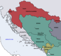
Datoteka:Map of the Kingdom of Croatia-Slavonia (1885).png
Map_of_the_Kingdom_of_Croatia-Slavonia_(1885).png (542 × 502 piksela, veličina datoteke: 31 KB, MIME tip: image/png)
Historija datoteke
Kliknite na datum/vrijeme da vidite verziju datoteke iz tog vremena.
| Datum/vrijeme | Smanjeni pregled | Dimenzije | Korisnik | Komentar | |
|---|---|---|---|---|---|
| trenutno | 13:11, 11 oktobar 2009 |  | 542 × 502 (31 KB) | DIREKTOR | {{Information |Description={{en|1=Map of the Kingdom of Croatia Slavonia cca. 1885. The Kingdom was a part of Transleithanian Austria-Hungary, the Kingdom of Hungary (Lands of the Crown of St. Stephen).}} |Source={{own}} |Author=DIREKTOR |
| 13:07, 11 oktobar 2009 |  | 542 × 502 (33 KB) | DIREKTOR | {{Information |Description={{en|1=Map of the Kingdom of Croatia Slavonia cca. 1885. The Kingdom was a part of Transleithanian Austria-Hungary, the Kingdom of Hungary (Lands of the Crown of St. Stephen).}} |Source={{own}} |Author=DIREKTOR | |
| 23:31, 10 oktobar 2009 |  | 542 × 502 (33 KB) | DIREKTOR | {{Information |Description={{en|1=Map of the Kingdom of Croatia Slavonia cca. 1885. The Kingdom was a part of Transleithanian Austria-Hungary, the Kingdom of Hungary (Lands of the Crown of St. Stephen).}} |Source={{own}} |Author=DIREKTOR |
Upotreba datoteke
Sljedeća stranica koristi ovu datoteku:
Globalna upotreba datoteke
Sljedeći wikiji koriste ovu datoteku:
- Upotreba na ar.wikipedia.org
- Upotreba na en.wikipedia.org
- Upotreba na fr.wikipedia.org
- Upotreba na ga.wikipedia.org
- Upotreba na he.wikipedia.org
- Upotreba na id.wikipedia.org
- Upotreba na ka.wikipedia.org
- Upotreba na ko.wikipedia.org
- Upotreba na ku.wikipedia.org
- Upotreba na pt.wikipedia.org
- Upotreba na sk.wikipedia.org
- Upotreba na sr.wikipedia.org
- Upotreba na tr.wikipedia.org
- Upotreba na uk.wikipedia.org
- Upotreba na www.wikidata.org

