
Datoteka:MountSidleyWaescheMap.jpg

Veličina ovog prikaza: 750 × 600 piksela. Ostale rezolucije: 300 × 240 piksela | 600 × 480 piksela | 1.000 × 800 piksela.
Izvorna datoteka (1.000 × 800 piksela, veličina datoteke: 181 KB, MIME tip: image/jpeg)
| Ova datoteka je s Wikimedia Commonsa. Opis s njene stranice opisa datoteke prikazan je ispod. Commons je skladište slobodnih medija i datoteka za sve projekte fondacije Wikimedia. Možete i Vi pomoći. |
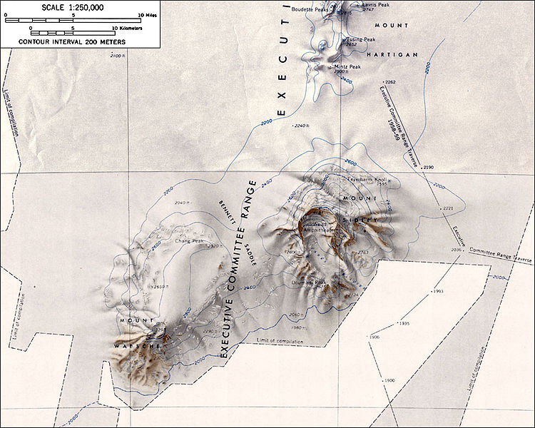
Topographic map of Mounts Sidley and Waesche (1:250,000 scale)
Source: http://usarc.usgs.gov/antarctic_atlas/ USGS Atlas of Antarctic Research
This image is in the public domain in the United States because it only contains materials that originally came from the United States Geological Survey, an agency of the United States Department of the Interior. For more information, see the official USGS copyright policy.
|
Historija datoteke
Kliknite na datum/vrijeme da vidite verziju datoteke iz tog vremena.
| Datum/vrijeme | Smanjeni pregled | Dimenzije | Korisnik | Komentar | |
|---|---|---|---|---|---|
| trenutno | 02:51, 16 januar 2005 | | 1.000 × 800 (181 KB) | GarciaB~commonswiki | Topographic map of Mounts Sidley and Waesche (1:250,000 scale) |
Upotreba datoteke
Sljedeća stranica koristi ovu datoteku:
Globalna upotreba datoteke
Sljedeći wikiji koriste ovu datoteku:
- Upotreba na ar.wikipedia.org
- Upotreba na ast.wikipedia.org
- Upotreba na bg.wikipedia.org
- Upotreba na ceb.wikipedia.org
- Upotreba na de.wikipedia.org
- Upotreba na en.wikipedia.org
- Upotreba na es.wikipedia.org
- Upotreba na fr.wikipedia.org
- Upotreba na ja.wikipedia.org
- Upotreba na lld.wikipedia.org
- Upotreba na nn.wikipedia.org
- Upotreba na no.wikipedia.org
- Upotreba na pl.wikipedia.org
- Upotreba na ru.wikipedia.org
- Upotreba na sv.wikipedia.org
- Upotreba na tr.wikipedia.org
- Upotreba na uk.wikipedia.org
- Upotreba na www.wikidata.org
- Upotreba na zh.wikipedia.org