
Datoteka:Relief Map of Poland.svg

Veličina ovog PNG pregleda za ovu SVG datoteku: 617 × 600 piksela. Ostale rezolucije: 247 × 240 piksela | 494 × 480 piksela | 790 × 768 piksela | 1.053 × 1.024 piksela | 2.107 × 2.048 piksela | 861 × 837 piksela.
Izvorna datoteka (SVG datoteka, nominalno 861 × 837 piksela, veličina datoteke: 4 MB)
| Ova datoteka je s Wikimedia Commonsa. Opis s njene stranice opisa datoteke prikazan je ispod. Commons je skladište slobodnih medija i datoteka za sve projekte fondacije Wikimedia. Možete i Vi pomoći. |
Sažetak
| Opis |
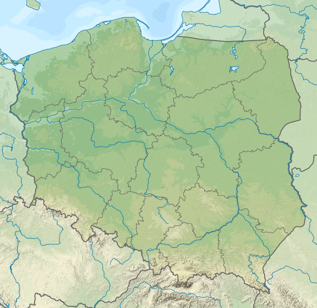
Deutsch: Positionskarte von Polen
Quadratische Plattkarte, N-S-Streckung 160 %. Geographische Begrenzung der Karte:
English: Location map of Poland
Equirectangular projection, N/S stretching 160 %. Geographic limits of the map:
|
| Datum | |
| Izvor |
Vlastito djelo This vector image includes elements that have been taken or adapted from this file: This vector image includes elements that have been taken or adapted from this file: |
| Autor |
TUBS |
| Ostale verzije |
|
| SVG genesis | This map was created with Adobe Illustrator by TUBS. |


Licenciranje
Ja, vlasnik autorskog prava ovog djela, ovdje ga objavljujem pod sljedećom licencom:
Ova datoteka je licencirana pod Creative Commons Attribution-Share Alike 3.0 neportiranom licencom.
- Slobodni ste:
- da dijelite – da kopirate, distributirate i prenosite djelo
- da remiksate – da prilagodite djelo
- Pod sljedećim uslovima:
- pripisivanje – Morate pripisati odgovarajuće autorske zasluge, osigurati link ka licenci i naznačiti jesu li napravljene izmjene. To možete uraditi na bilo koji razumni način, ali ne tako da se sugerira da davalac licence odobrava Vas ili Vašu upotrebu njegovog djela.
- dijeli pod istim uslovima – Ako mijenjate, transformišete ili nadograđujete ovaj materijal, morate ga objaviti i distribuirati samo pod istom ili sličnom licencom poput ove.

|
I'd greatly appreciate, that you attribute this media file to Wikimedia Commons, if used outside Wikipedia or Commons. For use in publications such as books, newspapers, blogs, websites, please insert here the following line:
|
Historija datoteke
Kliknite na datum/vrijeme da vidite verziju datoteke iz tog vremena.
| Datum/vrijeme | Smanjeni pregled | Dimenzije | Korisnik | Komentar | |
|---|---|---|---|---|---|
| trenutno | 01:20, 1 decembar 2021 | | 861 × 837 (4 MB) | Puck04 | fixed SVG code (was "W3C-invalid") + cleanup using text editor; contains raster graphics however |
| 22:54, 3 februar 2021 |  | 861 × 837 (4,18 MB) | SANtosito | Vectorized topo | |
| 23:52, 30 novembar 2011 |  | 861 × 837 (4,87 MB) | TUBS | == {{int:filedesc}} == {{Information |Description={{en|Relief map of Poland}} Equirectangular projection, N/S stretching 160 %. Geographic limits of the map: * N: 55.2° N * S: 48.7° N * W: 13.8° E * E: 24.5° E |Source={{own}}{{Adobe Il |
Upotreba datoteke
Sljedećih 7 stranica koristi ovu datoteku:
Globalna upotreba datoteke
Sljedeći wikiji koriste ovu datoteku:
- Upotreba na ab.wikipedia.org
- Upotreba na als.wikipedia.org
- Upotreba na ar.wikipedia.org
- Upotreba na av.wikipedia.org
- Upotreba na azb.wikipedia.org
- Upotreba na az.wikipedia.org
- Şablon:Yer xəritəsi Polşa
- Əyri meşə
- Slovinski Milli Parkı
- Dzivna boğazı
- Yamno gölü
- Baltik dili
- Şablon:Dil (coğrafiya)
- Şablon:Dil (coğrafiya)/doc
- Xel dili
- Blendovka səhrası
- Morskie Oko gölü
- Belka-Snejna mağarası
- Karsibur adası
- Ambarlar adası
- Qrabovski adası
- Haliç dağı
- Jives gölü
- Rozeve burnu
- Lısa-Gora dağı
- Avqustovskaya puşa
- Tuxolskie borı
- Rastoçe
- Rominten meşəsi
- Solina gölü
- Qartal Yuvası təbiət parkı
- Upotreba na ban.wikipedia.org
- Taman Nasional Tatra, Polandia
- Taman Nasional Bieszczady
- Lis taman nasional ring Polandia
- Taman Nasional Wielkopolska
- Taman Nasional Pieniny (Polandia)
- Taman Nasional Gorce
- Taman Nasional Babia Góra
- Taman Nasional Białowieża
- Taman Nasional Biebrza
- Taman Nasional Kampinos
- Taman Nasional Narew
- Taman Nasional Wigry
- Taman Nasional Magura
- Taman Nasional Roztocze
- Taman Nasional Polesie
- Taman Nasional Świętokrzyski
- Taman Nasional Ojców
Pogledajte globalne upotrebe ove datoteke.