
Datoteka:Strokkur geyser eruption, close-up view.jpg
Veličina ovog prikaza: 800 × 533 piksela. Ostale rezolucije: 320 × 213 piksela | 640 × 426 piksela | 1.024 × 682 piksela | 1.280 × 853 piksela | 2.977 × 1.983 piksela.
Izvorna datoteka (2.977 × 1.983 piksela, veličina datoteke: 695 KB, MIME tip: image/jpeg)
| Ova datoteka je s Wikimedia Commonsa. Opis s njene stranice opisa datoteke prikazan je ispod. Commons je skladište slobodnih medija i datoteka za sve projekte fondacije Wikimedia. Možete i Vi pomoći. |
| Opis |
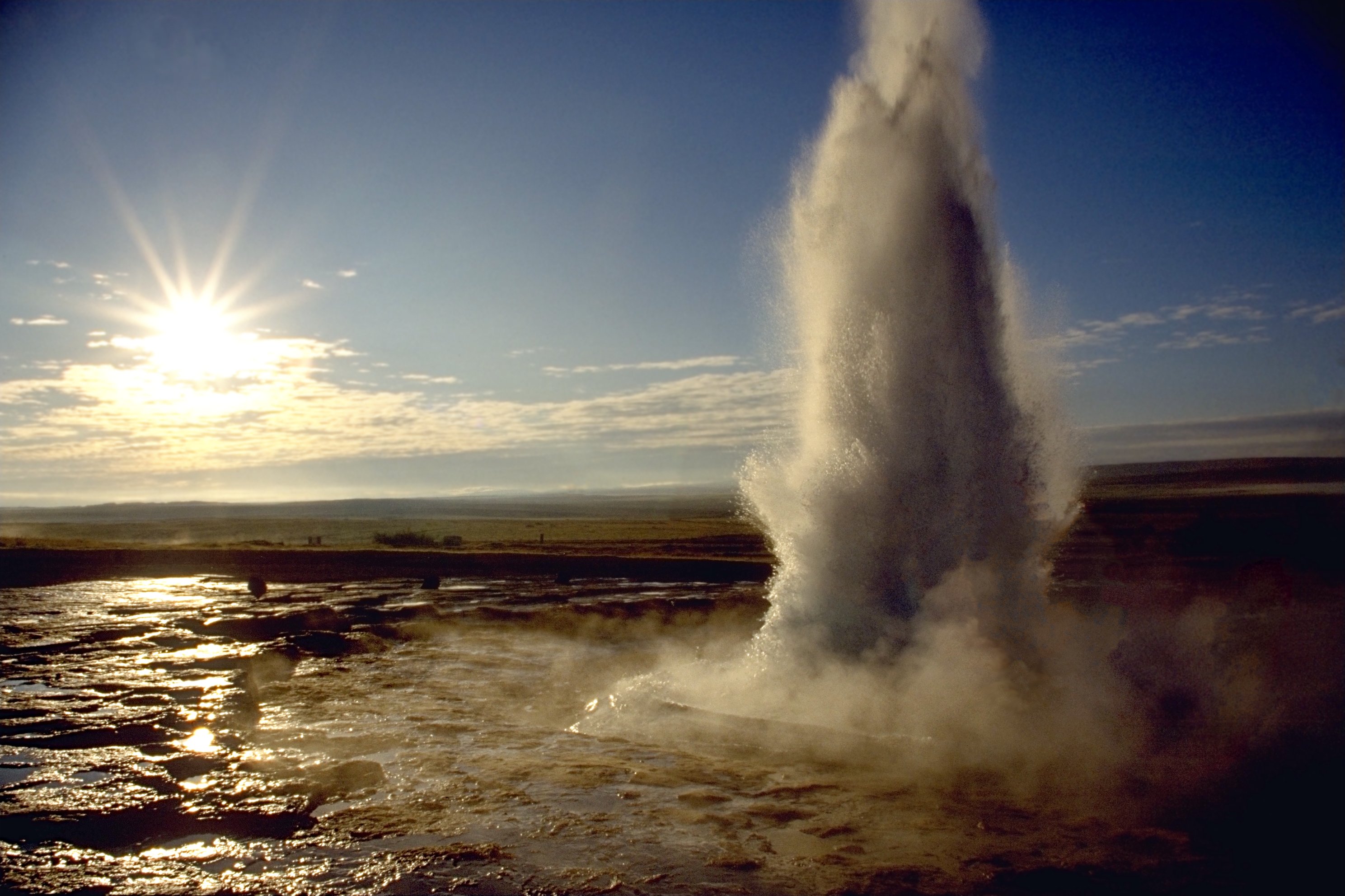
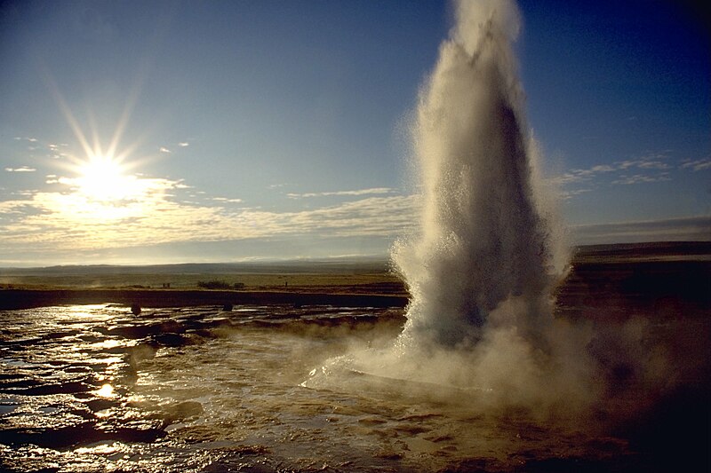
العربية: انفجار الفوَّارة الحارَّة «ستروكر».
Deutsch: Ein Ausbruch des Strokkur auf Island.
English: Eruption of Strokkur close by.
Français : Une éruption du Strokkur, en Islande. |
||
| Datum | |||
| Izvor |
Vlastito djelo - see http://fam-tille.de/sparetime.html |
||
| Autor | Andreas Tille | ||
| Dopuštenje (Naknadno korištenje ove datoteke) |
Quote of http://fam-tille.de/island/iceland/geysir/1998_088.html - Permission is granted to copy, distribute and/or modify this images under the terms of the GNU Free Documentation License, Version 1.1 or any later version published by the Free Software Foundation. Ja, vlasnik autorskog prava ovog djela, ovdje ga objavljujem pod sljedećim licencama:
Ova datoteka je licencirana pod Creative Commons Attribution-Share Alike 3.0 neportovanom, 2.5 generičkom, 2.0 generičkom i 1.0 generičkom licencom.
Možete odabrati licencu po vašem izboru. |

| Camera location | | View this and other nearby images on: OpenStreetMap |
|---|
| Camera Model | Minolta 600si |
|---|---|
| Lens | 28-80 |
| Filter(s) | none |
| Support | simple tripod |
| Film | Kodak slide |
|
This image was selected as picture of the day on Wikimedia Commons for 7 March 2005. It was captioned as follows: Other languages:
|
Historija datoteke
Kliknite na datum/vrijeme da vidite verziju datoteke iz tog vremena.
| Datum/vrijeme | Smanjeni pregled | Dimenzije | Korisnik | Komentar | |
|---|---|---|---|---|---|
| trenutno | 23:37, 9 decembar 2005 | | 2.977 × 1.983 (695 KB) | Tillea | |
| 08:16, 17 januar 2005 |  | 2.644 × 1.983 (542 KB) | Tillea | Eruption of Geysir close by |
Upotreba datoteke
Sljedeća stranica koristi ovu datoteku:
Globalna upotreba datoteke
Sljedeći wikiji koriste ovu datoteku:
- Upotreba na af.wikipedia.org
- Upotreba na an.wikipedia.org
- Upotreba na ar.wikipedia.org
- Upotreba na arz.wikipedia.org
- Upotreba na azb.wikipedia.org
- Upotreba na bg.wikipedia.org
- Upotreba na bh.wikipedia.org
- Upotreba na bn.wikipedia.org
- Upotreba na ca.wikipedia.org
- Upotreba na csb.wikipedia.org
- Upotreba na cs.wikipedia.org
- Upotreba na cy.wikipedia.org
- Upotreba na da.wikipedia.org
- Upotreba na da.wiktionary.org
- Upotreba na de.wikipedia.org
- Upotreba na de.wikibooks.org
- Upotreba na de.wiktionary.org
- Upotreba na en.wikipedia.org
Pogledajte globalne upotrebe ove datoteke.