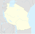
Datoteka:Tanzania location map.svg

Sadržaj stranice nije podržan na drugim jezicima.
S Wikipedije, slobodne enciklopedije

Izvorna datoteka(SVG datoteka, nominalno 3.302 × 3.143 piksela, veličina datoteke: 1,04 MB)

Sažetak

Opis
Afrikaans: Liggingkaart van Tanzanië
English: Location map of Tanzania
Español: Mapa de georreferenciación de Tanzania
Français : Carte de géolocalisation de la Tanzanie
Equirectangular projection. 0.25° N, 28° W, 42° E, -13° S. Center : -6.375 35
Datum (UTC)
Izvor
Autor
Ostale verzije

Derivative works of this file:  Iringa Regionen.png [uredi]

Pripisivanje
(required by the license)
InfoField
© Sémhur / Wikimedia Commons / 
© Sémhur / Wikimedia Commons
SVG
InfoField
 
W3C-validity not checked.
 
This W3C-unspecified vector image was created with Inkscape…important .
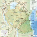
This is a retouched picture, which means that it has been digitally altered from its original version. Modifications: Cropped, and prepared for geolocation.. The original can be viewed here: Tanzania map-fr.svg. Modifications made by Sémhur.

Graphic Lab
InfoField
Object location6° 22′ 30″ S, 35° 00′ 00″ E  Heading=1° Kartographer map based on OpenStreetMap.View this and other nearby images on: OpenStreetMapinfo

Licenciranje

Ja, vlasnik autorskog prava ovog djela, ovdje ga objavljujem pod sljedećim licencama:
w:bs:Creative Commons
pripisivanje dijeli pod istim uslovima
This file is licensed under the Creative Commons Attribution-Share Alike 4.0 International, 3.0 Unported, 2.5 Generic, 2.0 Generic and 1.0 Generic license.
Slobodni ste:
  • da dijelite – da kopirate, distributirate i prenosite djelo
  • da remiksate – da prilagodite djelo
Pod sljedećim uslovima:
  • pripisivanje – Morate pripisati odgovarajuće autorske zasluge, osigurati link ka licenci i naznačiti jesu li napravljene izmjene. To možete uraditi na bilo koji razumni način, ali ne tako da se sugerira da davalac licence odobrava Vas ili Vašu upotrebu njegovog djela.
  • dijeli pod istim uslovima – Ako mijenjate, transformišete ili nadograđujete ovaj materijal, morate ga objaviti i distribuirati samo pod istom ili sličnom licencom poput ove.
Licence Art Libre Copyleft: Ovaj umjetnički rad je slobodan, možete ga redistribuirati i/ili izmijeniti u skladu sa uslovima Free Art License. Primjerak ove licence možete naći na Copyleft Attitude stranici kao i na drugim stranicama.
Možete odabrati licencu po vašem izboru.

Originalni zapisnik postavljanja

This image is a derivative work of the following images:

  • File:Tanzania_map-fr.svg licensed with Cc-by-sa-3.0,2.5,2.0,1.0, GFDL
    • 2009-03-20T13:30:18Z Sémhur 3096x3113 (3225659 Bytes) Ol Doinyo Lengaï was misplaced
    • 2009-03-20T11:14:35Z Sémhur 3096x3113 (3224368 Bytes) Add location map and few summits.
    • 2009-03-19T17:14:13Z Sémhur 3096x3113 (3099209 Bytes) grrr...
    • 2009-03-19T17:08:18Z Sémhur 3096x3113 (3099244 Bytes) Oups ! It wasn't the valid one.
    • 2009-03-19T17:05:02Z Sémhur 3096x3113 (3122421 Bytes) {{Information |Description={{en|1=Map of [[:en:Tanzania]].}} {{fr|1=Carte de la [[:fr:Tanzanie]].}} {{es|1=Mapa de [[:es:Tanzania]].}} |Source=travail personnel (own work). Sources of data: * Elevations : NASA SRTM3 (public d

Uploaded with derivativeFX

Originalni zapisnik postavljanja

date/time username resolution size edit summary
2009-05-03T08:48:31Z User:Sémhur 3096×2947 828.71Kb borders above waters
2009-05-03T08:45:18Z User:Sémhur 3096×2947 828.72Kb Adding border between Arusha and Manyara
2009-05-01T18:46:42Z User:Sémhur 3096×2947 822.6Kb {{int:summary}} {{Information |Description={{en|1=Location map of [[:en:Tanzania]].}} {{fr|1=Carte de géolocalisation de la [[:fr:Tanzanie]].}} {{es|1=Mapa de georreferenciación de [[:es:Tanzania]].}} Equirectangular projection. 0.25° N, 28° W, 42°

Captions

Add a one-line explanation of what this file represents
Location map of Tanzania

Items portrayed in this file

prikazuje

6°S, 35°E

heading engleski: 1 stepen

MIME type engleski

image/svg+xml

Historija datoteke

Kliknite na datum/vrijeme da vidite verziju datoteke iz tog vremena.

Datum/vrijemeSmanjeni pregledDimenzijeKorisnikKomentar
trenutno22:15, 25 maj 2017Smanjeni pregled verzije na dan 22:15, 25 maj 20173.302 × 3.143 (1,04 MB)SémhurUpdated with Songwe Region
16:16, 13 decembar 2013Smanjeni pregled verzije na dan 16:16, 13 decembar 20133.096 × 2.947 (1,03 MB)SémhurUpdated with the four new regions
02:30, 25 juli 2009Smanjeni pregled verzije na dan 02:30, 25 juli 20093.096 × 2.947 (829 KB)BetacommandBotmove approved by: User:Sémhur This image was moved from File:Tanzania location equirectangular map.svg =={{int:summary}}== {{Information |Description={{en|1=Location map of en:Tanzania.}} {{fr|1=Carte de géolocalisation de la [[:fr:Tanz

Sljedeća stranica koristi ovu datoteku:

Globalna upotreba datoteke

Metapodaci