
Datoteka:Yugoslavia map 1920.jpg

Veličina ovog prikaza: 800 × 530 piksela. Ostale rezolucije: 320 × 212 piksela | 640 × 424 piksela.
Izvorna datoteka (906 × 600 piksela, veličina datoteke: 192 KB, MIME tip: image/jpeg)
| Ova datoteka je s Wikimedia Commonsa. Opis s njene stranice opisa datoteke prikazan je ispod. Commons je skladište slobodnih medija i datoteka za sve projekte fondacije Wikimedia. Možete i Vi pomoći. |
Sažetak
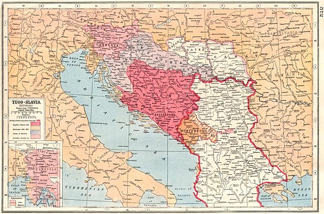
| Opis | Old map of Yugoslavia from 1920. |
| Datum | |
| Izvor | [1] [2] (BALKANS:Yugoslavia Historical; Bosnia Serbia Montenegro; nationalities 1920 map; 1920; Harmsworth's new Atlas) |
| Autor | Unsigned |
![[1]](http://www.antiquaprintgallery.com/ekmps/shops/richben90/images/balkans-yugoslavia-historical-bosnia-serbia-montenegro-nationalities-1920-map-120236-p.jpg)
Licenciranje
This work is in the public domain in the United States because it was published (or registered with the U.S. Copyright Office) before January 1, 1929.
Public domain works must be out of copyright in both the United States and in the source country of the work in order to be hosted on the Commons. If the work is not a U.S. work, the file must have an additional copyright tag indicating the copyright status in the source country.
Note: This tag should not be used for sound recordings. |
Historija datoteke
Kliknite na datum/vrijeme da vidite verziju datoteke iz tog vremena.
| Datum/vrijeme | Smanjeni pregled | Dimenzije | Korisnik | Komentar | |
|---|---|---|---|---|---|
| trenutno | 11:34, 6 oktobar 2012 | | 906 × 600 (192 KB) | PANONIAN | {{Information |Description=Old map of Yugoslavia from 1920. |Source= http://www.antiquaprintgallery.com/ekmps/shops/richben90/images/balkans-yugoslavia-historical-bosnia-serbia-montenegro-nationalities-1920-map-120236-p.jpg http://www.antiquaprintgalle... |
Upotreba datoteke
Nema stranica koje koriste ovu datoteku.
Globalna upotreba datoteke
Sljedeći wikiji koriste ovu datoteku:
- Upotreba na ru.wikipedia.org
- Upotreba na sh.wikipedia.org
- Upotreba na sr.wikipedia.org
- Upotreba na uk.wikipedia.org