
Datoteka:Andes1a.JPG

Veličina ovog prikaza: 800 × 595 piksela. Ostale rezolucije: 320 × 238 piksela | 640 × 476 piksela | 1.024 × 761 piksela | 1.280 × 952 piksela | 1.380 × 1.026 piksela.
Izvorna datoteka (1.380 × 1.026 piksela, veličina datoteke: 962 KB, MIME tip: image/jpeg)
| Ova datoteka je s Wikimedia Commonsa. Opis s njene stranice opisa datoteke prikazan je ispod. Commons je skladište slobodnih medija i datoteka za sve projekte fondacije Wikimedia. Možete i Vi pomoći. |
Sažetak
| Opis |
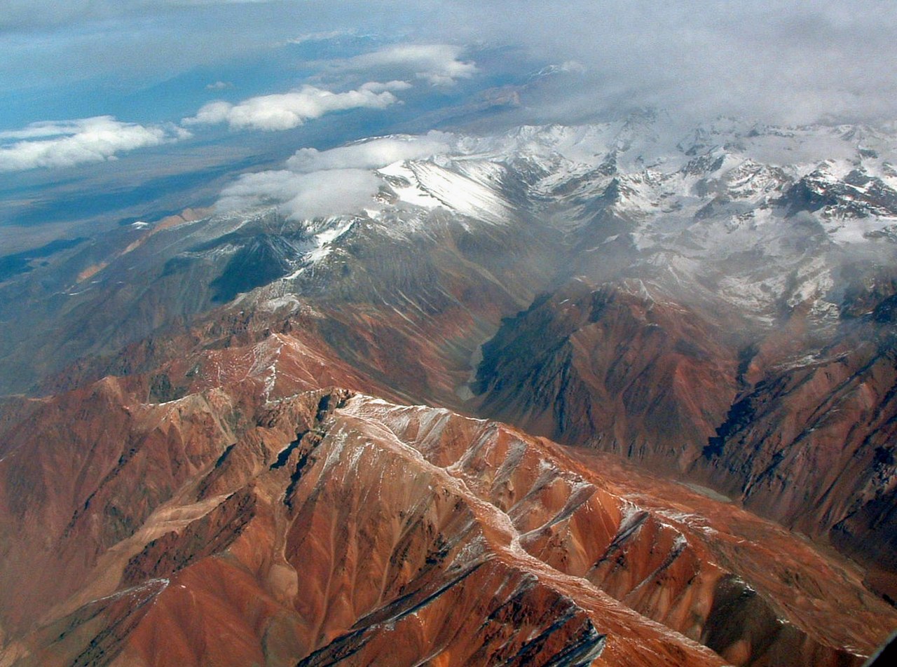
English: The Andes. Photo was taken on a flight between Asuncion, Paraguay and Santiago, Chile, so the exact location is probably in the area between Santiago, Chile and Cordoba, Argentina. This is on the Argentina side. On the left Cordón del Plata, on the right Cordón de la Jaula, between them Quebrada de la Jaula. Cerro Blanco (5127 m a.s.l.) in the foreground. |
| Datum | |
| Izvor | Wikipedia:Contact us/Photo submission |
| Autor | Robert Morrow |
| Dopuštenje (Naknadno korištenje ove datoteke) |
Ova datoteka je licencirana pod Creative Commons Attribution-Share Alike 3.0 neportiranom licencom.
|
| Object location | | View this and other nearby images on: OpenStreetMap |
|---|
Historija datoteke
Kliknite na datum/vrijeme da vidite verziju datoteke iz tog vremena.
| Datum/vrijeme | Smanjeni pregled | Dimenzije | Korisnik | Komentar | |
|---|---|---|---|---|---|
| trenutno | 20:44, 10 novembar 2008 | | 1.380 × 1.026 (962 KB) | Holly Cheng | == Summary == {{Information |Description={{en|1=The Andes. Photo was taken on a flight between Asuncion, Paraguay and Santiago, Chile, so the exact location is probably in the area between Santiago, Chile and Cordoba, Argentina. This is on the Argentina s |
Upotreba datoteke
Sljedeća stranica koristi ovu datoteku:
Globalna upotreba datoteke
Sljedeći wikiji koriste ovu datoteku:
- Upotreba na ay.wikipedia.org
- Upotreba na ca.wikipedia.org
- Upotreba na cs.wikipedia.org
- Upotreba na cy.wikipedia.org
- Upotreba na en.wikipedia.org
- Upotreba na et.wikipedia.org
- Upotreba na fr.wikipedia.org
- Upotreba na gn.wikipedia.org
- Upotreba na kk.wikipedia.org
- Upotreba na kn.wikipedia.org
- Upotreba na ko.wikipedia.org
- Upotreba na ky.wikipedia.org
- Upotreba na ml.wikipedia.org
- Upotreba na oc.wikipedia.org
- Upotreba na or.wikipedia.org
- Upotreba na simple.wikipedia.org
- Upotreba na sr.wikipedia.org
- Upotreba na vi.wikipedia.org