Datoteka:England Southampton area location map.svg

Sadržaj stranice nije podržan na drugim jezicima.
S Wikipedije, slobodne enciklopedije

Izvorna datoteka(SVG datoteka, nominalno 170 × 147 piksela, veličina datoteke: 383 KB)

Sažetak

Opis
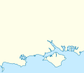
English: Sea and land outline of the centre of the south coast of England from Portland Bill to Selsey Bill: principally Weymouth and Bournemouth Bays with the Isle of Wight cut off from the mainland by the Solent. The mainland has 8 main harbours/inlets: Weymouth, Poole (in which Brownsea Island is shown), Christchurch, Lymington, the Beaulieu River, Southampton Water, Portsmouth, Langstone and Chichester.

Equirectangular projection, N/S stretching 170 %. Geographic limits of the map:

  • N: 51.326° N
  • S: 50.528° N
  • W: 2.339° W
  • E: 0.627° W
Izvor File:England location map.svg
Autor NordNordWest

Licenciranje

Ja, vlasnik autorskog prava ovog djela, ovdje ga objavljujem pod sljedećom licencom:
w:bs:Creative Commons
pripisivanje dijeli pod istim uslovima
Ova datoteka je licencirana pod Creative Commons Attribution-Share Alike 3.0 neportiranom licencom.
Slobodni ste:
  • da dijelite – da kopirate, distributirate i prenosite djelo
  • da remiksate – da prilagodite djelo
Pod sljedećim uslovima:
  • pripisivanje – Morate pripisati odgovarajuće autorske zasluge, osigurati link ka licenci i naznačiti jesu li napravljene izmjene. To možete uraditi na bilo koji razumni način, ali ne tako da se sugerira da davalac licence odobrava Vas ili Vašu upotrebu njegovog djela.
  • dijeli pod istim uslovima – Ako mijenjate, transformišete ili nadograđujete ovaj materijal, morate ga objaviti i distribuirati samo pod istom ili sličnom licencom poput ove.

Captions

Add a one-line explanation of what this file represents
The cluster of many inlets and harbours, two large bays and a large island channel forming the central area of the coast of southern England.

Items portrayed in this file

prikazuje

Historija datoteke

Kliknite na datum/vrijeme da vidite verziju datoteke iz tog vremena.

Datum/vrijemeSmanjeni pregledDimenzijeKorisnikKomentar
trenutno21:19, 3 august 2014Smanjeni pregled verzije na dan 21:19, 3 august 2014170 × 147 (383 KB)MahahahaneapneapExpanded
20:51, 3 august 2014Smanjeni pregled verzije na dan 20:51, 3 august 2014160 × 137 (428 KB)MahahahaneapneapMore space to the north
03:59, 22 septembar 2013Smanjeni pregled verzije na dan 03:59, 22 septembar 2013160 × 127 (428 KB)Mahahahaneapneap{{Information |Description ={{en|1=Map of Southern England Equirectangular projection, N/S stretching 170 %. Geographic limits of the map: * N: 51.326° N * S: 50.528° N * W: 2.339° W * E: 0.627° W}} |Source =[[:File:England location ma...

Sljedeća stranica koristi ovu datoteku:

Globalna upotreba datoteke

Metapodaci