
Datoteka:GulfofMexico3D.jpg

Veličina ovog prikaza: 734 × 600 piksela. Ostale rezolucije: 294 × 240 piksela | 588 × 480 piksela | 940 × 768 piksela | 1.253 × 1.024 piksela | 2.507 × 2.048 piksela | 3.000 × 2.451 piksela.
Izvorna datoteka (3.000 × 2.451 piksela, veličina datoteke: 508 KB, MIME tip: image/jpeg)
| Ova datoteka je s Wikimedia Commonsa. Opis s njene stranice opisa datoteke prikazan je ispod. Commons je skladište slobodnih medija i datoteka za sve projekte fondacije Wikimedia. Možete i Vi pomoći. |
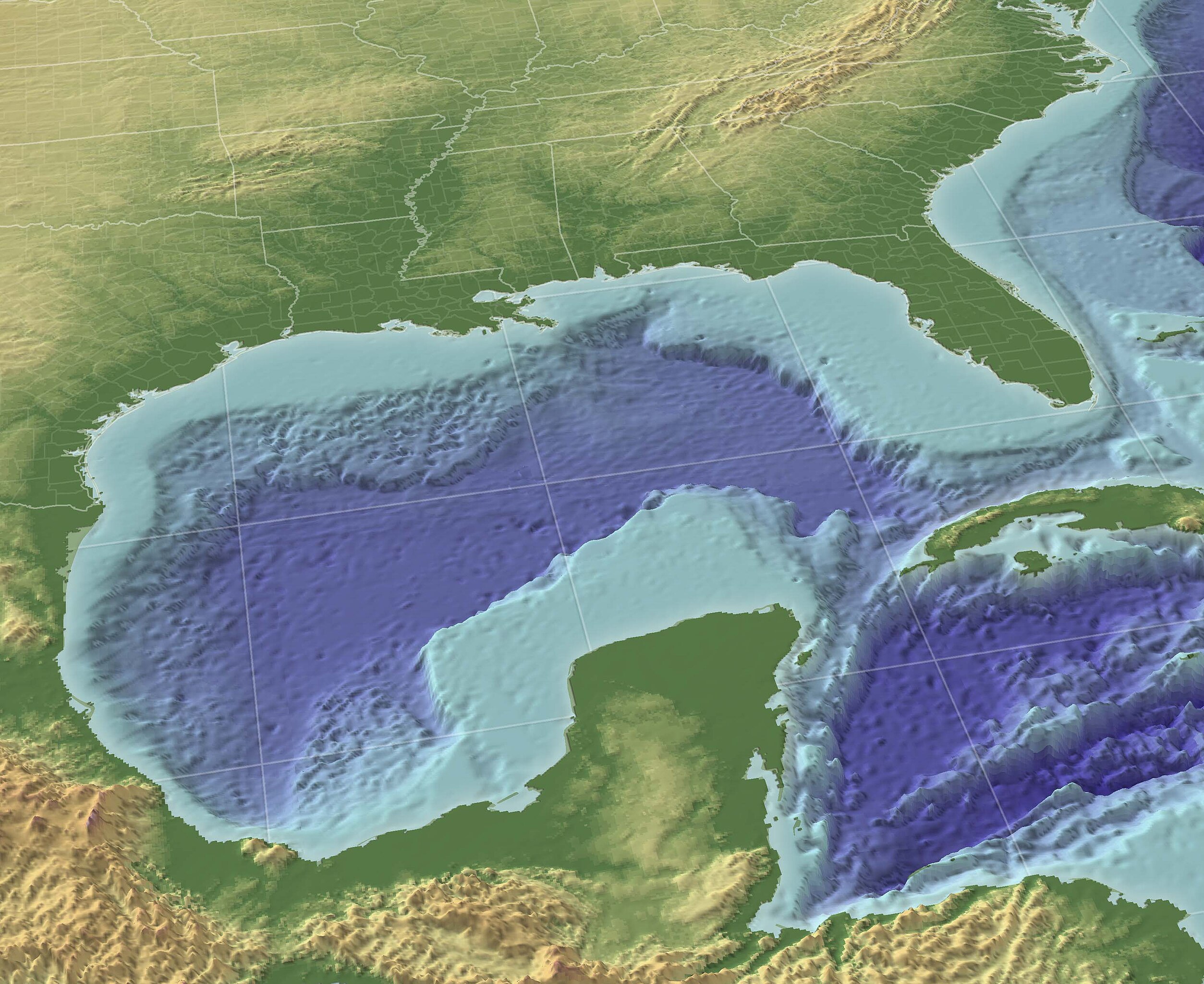
"The Gulf of Mexico in 3D perspective. A GIS can create very accurate and realistic-looking environments." Source (High-Res: 3000x2451).
This image is in the public domain because it contains materials that originally came from the U.S. National Oceanic and Atmospheric Administration, taken or made as part of an employee's official duties.
|
From English wikipedia w:en:Image:GulfofMexico3D.png
Historija datoteke
Kliknite na datum/vrijeme da vidite verziju datoteke iz tog vremena.
| Datum/vrijeme | Smanjeni pregled | Dimenzije | Korisnik | Komentar | |
|---|---|---|---|---|---|
| trenutno | 12:30, 13 novembar 2009 | | 3.000 × 2.451 (508 KB) | Justass | resolution |
| 20:36, 19 maj 2005 |  | 1.024 × 837 (545 KB) | Gengiskanhg | "The Gulf of Mexico in 3D perspective. A GIS can create very accurate and realistic-looking environments." [http://oceanexplorer.noaa.gov/technology/tools/mapping/media/GulfofMexico.jpg Source] (High-Res: 3000x2451). {{PD-USGov-NOAA}} From US wikipedia |
Upotreba datoteke
Sljedeća stranica koristi ovu datoteku:
Globalna upotreba datoteke
Sljedeći wikiji koriste ovu datoteku:
- Upotreba na af.wikipedia.org
- Upotreba na an.wikipedia.org
- Upotreba na ar.wikipedia.org
- Upotreba na ast.wikipedia.org
- Upotreba na avk.wikipedia.org
- Upotreba na azb.wikipedia.org
- Upotreba na az.wikipedia.org
- Upotreba na az.wiktionary.org
- Upotreba na ba.wikipedia.org
- Upotreba na be-tarask.wikipedia.org
- Upotreba na be.wikipedia.org
- Upotreba na br.wikipedia.org
- Upotreba na ca.wikipedia.org
- Upotreba na ce.wikipedia.org
- Upotreba na cs.wikipedia.org
- Upotreba na cv.wikipedia.org
- Upotreba na cy.wikipedia.org
- Upotreba na da.wikipedia.org
- Upotreba na de.wikipedia.org
- Upotreba na en.wikipedia.org
- Upotreba na en.wikibooks.org
- Upotreba na en.wikinews.org
- Upotreba na en.wiktionary.org
- Upotreba na eo.wikipedia.org
- Upotreba na es.wikipedia.org
Pogledajte globalne upotrebe ove datoteke.