
Datoteka:Heidelberg Stadtteile 2012.svg

Veličina ovog PNG pregleda za ovu SVG datoteku: 798 × 599 piksela. Ostale rezolucije: 320 × 240 piksela | 639 × 480 piksela | 1.022 × 768 piksela | 1.280 × 962 piksela | 2.560 × 1.923 piksela | 2.034 × 1.528 piksela.
Izvorna datoteka (SVG datoteka, nominalno 2.034 × 1.528 piksela, veličina datoteke: 1,03 MB)
| Ova datoteka je s Wikimedia Commonsa. Opis s njene stranice opisa datoteke prikazan je ispod. Commons je skladište slobodnih medija i datoteka za sve projekte fondacije Wikimedia. Možete i Vi pomoći. |
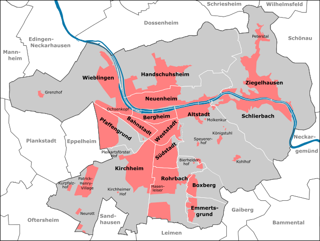
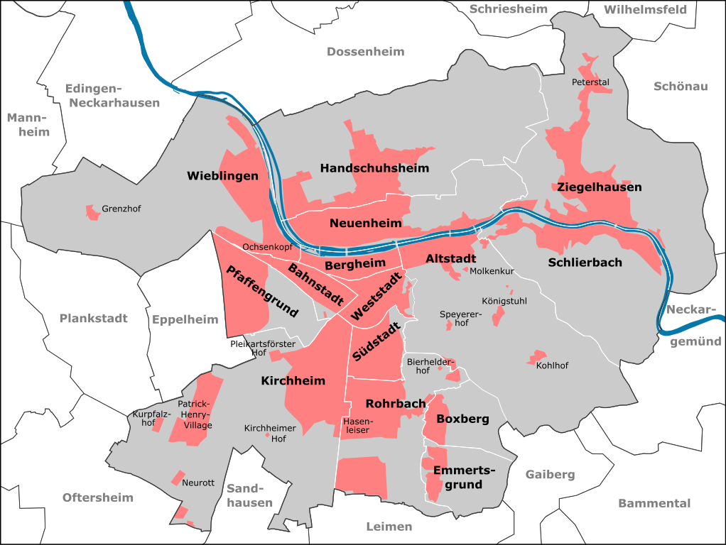
| Opis | Stadtteile Heidelbergs ab 2012 | ||||||||||||||||||||||||||||
| Datum | |||||||||||||||||||||||||||||
| Izvor |
|
||||||||||||||||||||||||||||
| Autor | Pitichinaccio (talk) | ||||||||||||||||||||||||||||
Historija datoteke
Kliknite na datum/vrijeme da vidite verziju datoteke iz tog vremena.
| Datum/vrijeme | Smanjeni pregled | Dimenzije | Korisnik | Komentar | |
|---|---|---|---|---|---|
| trenutno | 12:41, 4 januar 2013 | | 2.034 × 1.528 (1,03 MB) | Pitichinaccio | erg. Edingen |
| 21:05, 1 januar 2013 |  | 2.034 × 1.528 (1,02 MB) | Pitichinaccio | {{Information |Description=Stadtteile Heidelbergs ab 2012 |Source={{OpenStreetMap | name = Heidelberg | location = Heidelberg | description = Map of Heidelberg, Germany | top = 49.4620 | bottom = 49.3510 | left ... |
Upotreba datoteke
Sljedeća stranica koristi ovu datoteku:
Globalna upotreba datoteke
Sljedeći wikiji koriste ovu datoteku:
- Upotreba na ast.wikipedia.org
- Upotreba na azb.wikipedia.org
- Upotreba na bg.wikipedia.org
- Upotreba na bn.wikipedia.org
- Upotreba na da.wikipedia.org
- Upotreba na de.wikipedia.org
- Upotreba na de.wikivoyage.org
- Upotreba na el.wikipedia.org
- Upotreba na en.wikipedia.org
- Upotreba na eo.wikipedia.org
- Upotreba na es.wikipedia.org
- Upotreba na fi.wikipedia.org
- Upotreba na fr.wikipedia.org
- Upotreba na he.wikipedia.org
- Upotreba na hr.wikipedia.org
- Upotreba na it.wikipedia.org
- Upotreba na it.wikivoyage.org
- Upotreba na ja.wikipedia.org
- Upotreba na mk.wikipedia.org
- Upotreba na no.wikipedia.org
- Upotreba na pl.wikipedia.org
- Upotreba na ro.wikipedia.org
- Upotreba na sco.wikipedia.org
- Upotreba na sl.wikipedia.org
- Upotreba na sr.wikipedia.org
- Upotreba na vi.wikipedia.org