
Datoteka:Location map San Francisco County.png
Veličina ovog prikaza: 698 × 600 piksela. Ostale rezolucije: 279 × 240 piksela | 559 × 480 piksela | 894 × 768 piksela | 1.192 × 1.024 piksela | 2.155 × 1.851 piksela.
Izvorna datoteka (2.155 × 1.851 piksela, veličina datoteke: 2,42 MB, MIME tip: image/png)
| Ova datoteka je s Wikimedia Commonsa. Opis s njene stranice opisa datoteke prikazan je ispod. Commons je skladište slobodnih medija i datoteka za sve projekte fondacije Wikimedia. Možete i Vi pomoći. |

|
This map image could be re-created using vector graphics as an SVG file. This has several advantages; see Commons:Media for cleanup for more information. If an SVG form of this image is available, please upload it and afterwards replace this template with
{{vector version available|new image name}}.
It is recommended to name the SVG file “Location map San Francisco County.svg”—then the template Vector version available (or Vva) does not need the new image name parameter. |
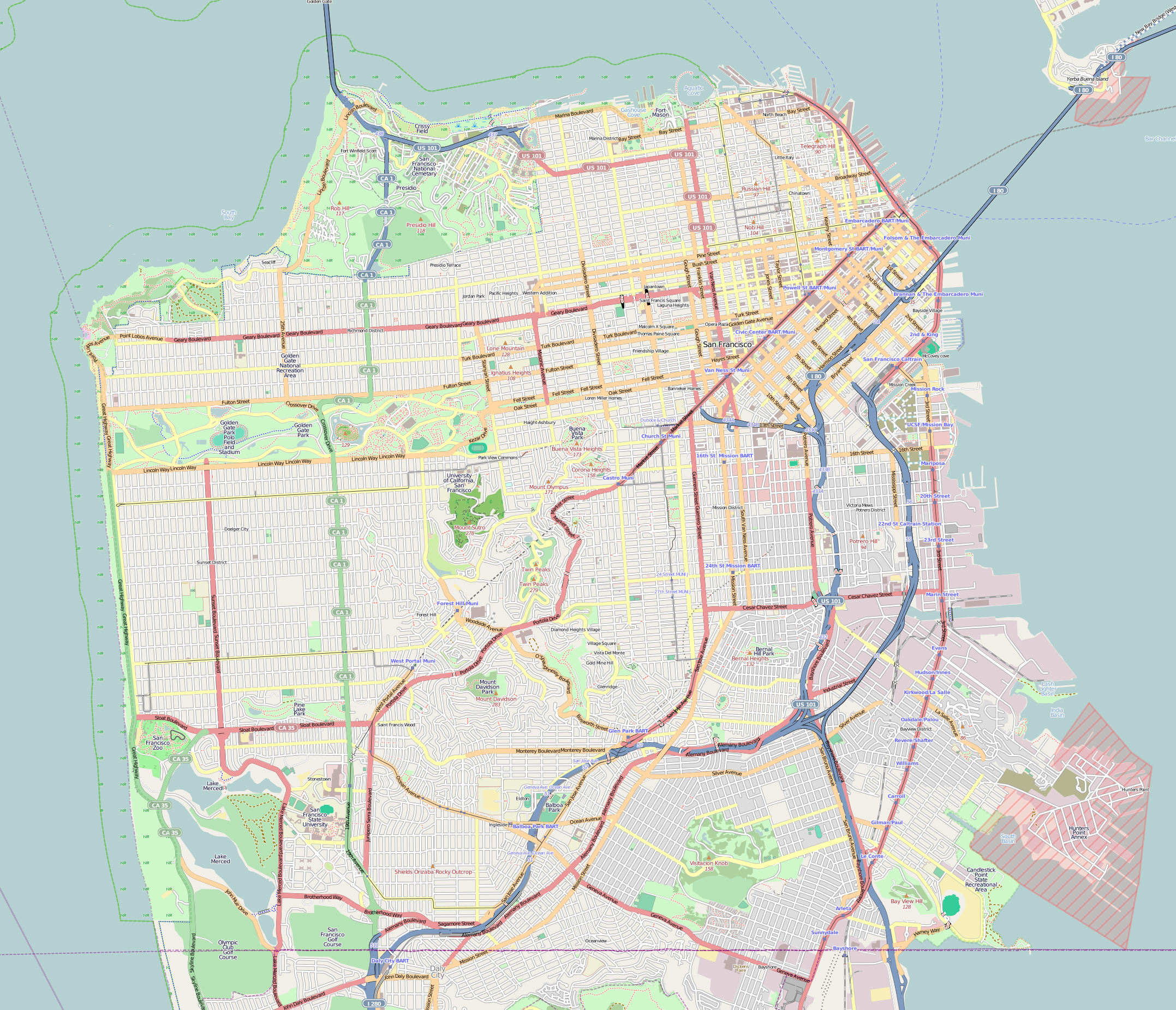
| Description |
This map of San Francisco and vicinity was created from OpenStreetMap project data, collected by the community. This map may be incomplete, and may contain errors. Don't rely solely on it for navigation. |
|||||||||
| Datum | (see file history) | |||||||||
| Izvor | openstreetmap.org | |||||||||
| Stvaralac |
OpenStreetMap contributors |
|||||||||
| Dopuštenje (Naknadno korištenje ove datoteke) |
OpenStreetMap data and maps are licensed under the Creative Commons Attribution-ShareAlike 2.0 license (CC-BY-SA 2.0). Ova datoteka je licencirana pod Creative Commons Attribution-Share Alike 2.0 generičkom licencom.
|
|||||||||
| Geotemporal data | ||||||||||
| Bounding box |
|
|||||||||
| Georeferencing | If inappropriate please set warp_status = skip to hide. | |||||||||
Historija datoteke
Kliknite na datum/vrijeme da vidite verziju datoteke iz tog vremena.
| Datum/vrijeme | Smanjeni pregled | Dimenzije | Korisnik | Komentar | |
|---|---|---|---|---|---|
| trenutno | 21:03, 9 decembar 2016 | | 2.155 × 1.851 (2,42 MB) | Jeanjung212 | Lossless Compressed/optimized png decreasing file size by 399140 bytes |
| 08:09, 8 februar 2011 |  | 2.155 × 1.851 (2,81 MB) | Droll | {{OpenStreetMap |location=San Francisco and vicinity |authors=Droll |top= 37.8191 |bottom= 37.7013 |left= -122.5265 |right= -122.353 }} Category:OpenStreetMap maps of the United States Category:Maps of San Francisco |
Upotreba datoteke
Sljedeće 2 stranice koriste ovu datoteku:
Globalna upotreba datoteke
Sljedeći wikiji koriste ovu datoteku:
- Upotreba na ar.wikipedia.org
- Upotreba na bh.wikipedia.org
- Upotreba na ceb.wikipedia.org
- Upotreba na en.wikipedia.org
- City Lights Bookstore
- Castro Theatre
- Richmond District, San Francisco
- Sunset District, San Francisco
- Oracle Park
- Coit Tower
- Asian Art Museum (San Francisco)
- Bayview–Hunters Point, San Francisco
- Grandview Park
- California Academy of Sciences
- San Francisco Botanical Garden
- Bernal Heights, San Francisco
- Mission Dolores Park
- Buena Vista Park
- Yerba Buena Gardens
- Lowell High School (San Francisco)
- Balclutha (1886)
- West Portal, San Francisco
- John McLaren Park
- Ghirardelli Square
- Cartoon Art Museum
- Glen Park, San Francisco
- Washington Square (San Francisco)
- Excelsior District, San Francisco
- Curran Theatre
- Crocker-Amazon, San Francisco
- Twin Peaks (San Francisco)
- Mount Davidson (California)
- American Conservatory Theater
- San Francisco Mint
- Candlestick Point State Recreation Area
- Cliff House, San Francisco
- Saint Ignatius Church (San Francisco)
- Fleishhacker Pool
- Lincoln Park (San Francisco)
- Columbus Tower (San Francisco)
- Musée Mécanique
- Lotta's Fountain
- San Francisco War Memorial and Performing Arts Center
- Holy Name of Jesus Church (San Francisco)
- Lone Mountain (California)
- Sutro Heights Park
- Visitacion Valley, San Francisco
- Rincon Center
- Aquatic Park Historic District
- List of hills in San Francisco
Pogledajte globalne upotrebe ove datoteke.