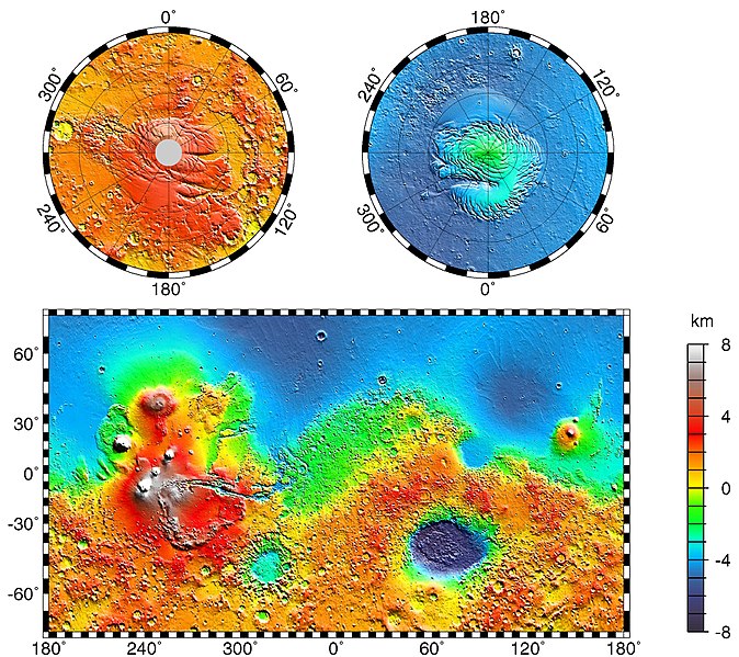
Datoteka:MarsTopoMap-PIA02031 modest.jpg

Veličina ovog prikaza: 674 × 600 piksela. Ostale rezolucije: 270 × 240 piksela | 540 × 480 piksela | 864 × 768 piksela | 1.151 × 1.024 piksela | 2.497 × 2.221 piksela.
Izvorna datoteka (2.497 × 2.221 piksela, veličina datoteke: 1,09 MB, MIME tip: image/jpeg)
Historija datoteke
Kliknite na datum/vrijeme da vidite verziju datoteke iz tog vremena.
| Datum/vrijeme | Smanjeni pregled | Dimenzije | Korisnik | Komentar | |
|---|---|---|---|---|---|
| trenutno | 02:43, 22 mart 2005 |  | 2.497 × 2.221 (1,09 MB) | Wikibob~commonswiki | high res jpg from http://photojournal.jpl.nasa.gov/jpeg/PIA02031.jpg PD |
| 18:40, 30 decembar 2004 |  | 612 × 545 (86 KB) | Kristaga | NASA-photo, all NASA images are free to use. |
Upotreba datoteke
Nema stranica koje koriste ovu datoteku.
Globalna upotreba datoteke
Sljedeći wikiji koriste ovu datoteku:
- Upotreba na als.wikipedia.org
- Upotreba na ar.wikipedia.org
- Upotreba na be.wikipedia.org
- Upotreba na bg.wikipedia.org
- Upotreba na bo.wikipedia.org
- Upotreba na ca.wikipedia.org
- Upotreba na ca.wikibooks.org
- Upotreba na cv.wikipedia.org
- Upotreba na de.wikipedia.org
- Upotreba na el.wikipedia.org
- Upotreba na en.wikipedia.org
- User:Mcdavis941/mars
- Wikipedia:Reference desk/Science/Archive
- User:Scholar743/subpage3
- Mars ocean theory
- Phaethontis quadrangle
- Water on Mars
- Ptolemaeus (Martian crater)
- Tader Valles
- Gorgonum Chaos
- Wikipedia:Reference desk/Archives/Science/2010 September 26
- User talk:Wikileadspresident
- List of largest craters in the Solar System
- User:Jimmarsmars/sandbox
- Lakes on Mars
- Upotreba na en.wikiversity.org
- Upotreba na es.wikipedia.org
- Upotreba na eu.wikipedia.org
- Upotreba na fa.wikipedia.org
- Upotreba na fi.wikipedia.org
- Upotreba na fr.wikipedia.org
- Upotreba na gl.wikipedia.org
- Upotreba na he.wikipedia.org
- Upotreba na hi.wikipedia.org
- Upotreba na hr.wikipedia.org
- Upotreba na hu.wikipedia.org
Pogledajte globalne upotrebe ove datoteke.


