
Datoteka:15th Arrondissement of Paris as seen from Pont de Bir-Hakeim 140507 1.jpg

Izvorna datoteka (7.578 × 3.991 piksela, veličina datoteke: 13,67 MB, MIME tip: image/jpeg)
| Ova datoteka je s Wikimedia Commonsa. Opis s njene stranice opisa datoteke prikazan je ispod. Commons je skladište slobodnih medija i datoteka za sve projekte fondacije Wikimedia. Možete i Vi pomoći. |
Sažetak
| Opis |
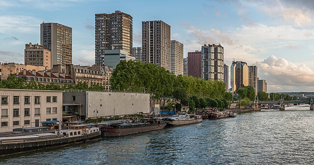
English: The 15th arrondissement of Paris as seen from the Pont de Bir-Hakeim, shortly before sunset.
Español: XV Distrito de París, Francia, visto desde el puente de Bir-Hakeim poco antes del atardecer.
|
||||
| Datum | |||||
| Izvor | Vlastito djelo | ||||
| Autor | DXR |


| Camera location | | View this and other nearby images on: OpenStreetMap |
|---|
Assessment
|
This image was selected as picture of the day on Wikimedia Commons for 7 May 2024. It was captioned as follows: English: The 15th arrondissement of Paris as seen from the Pont de Bir-Hakeim, shortly before sunset Other languages:
Bahasa Melayu: Pemandangan kawasan Arrondissements ke-15, dilihat dari Pont de Bir-Hakeim, sejurus sebelum matahari terbenam. Deutsch: Das 15. Pariser Arrondissement gesehen von der Pont de Bir-Hakeim kurz vor Sonnenuntergang. English: The 15th arrondissement of Paris as seen from the Pont de Bir-Hakeim, shortly before sunset Español: XV Distrito de París, Francia, visto desde el puente de Bir-Hakeim poco antes del atardecer. Magyar: Párizs 15. kerülete a Pont de Bir-Hakeimről nézve, röviddel naplemente előtt Nederlands: Het 15e arrondissement van de Franse hoofdstad Parijs, gezien vanaf de Pont de Bir-Hakeim Português: 15.º arrondissement de Paris, França, visto da Ponte de Bir-Hakeim pouco antes do pôr do sol. |
|
|
Panorama by DXR (Category)
The photograph above is a panoramic image which was created by me, Daniel Vorndran, and uploaded here as User:DXR.
Please note:
|


Licenciranje
- Slobodni ste:
- da dijelite – da kopirate, distributirate i prenosite djelo
- da remiksate – da prilagodite djelo
- Pod sljedećim uslovima:
- pripisivanje – Morate pripisati odgovarajuće autorske zasluge, osigurati link ka licenci i naznačiti jesu li napravljene izmjene. To možete uraditi na bilo koji razumni način, ali ne tako da se sugerira da davalac licence odobrava Vas ili Vašu upotrebu njegovog djela.
- dijeli pod istim uslovima – Ako mijenjate, transformišete ili nadograđujete ovaj materijal, morate ga objaviti i distribuirati samo pod istom ili sličnom licencom poput ove.
Historija datoteke
Kliknite na datum/vrijeme da vidite verziju datoteke iz tog vremena.
| Datum/vrijeme | Smanjeni pregled | Dimenzije | Korisnik | Komentar | |
|---|---|---|---|---|---|
| trenutno | 23:51, 3 juni 2014 | | 7.578 × 3.991 (13,67 MB) | DXR | Selective cloud brightening top right corner |
| 15:31, 2 juni 2014 |  | 7.578 × 3.991 (13,67 MB) | DXR | Slight straightening | |
| 15:09, 8 maj 2014 |  | 7.595 × 4.000 (14,38 MB) | DXR | Spots removed | |
| 14:59, 8 maj 2014 |  | 7.595 × 4.000 (14,3 MB) | DXR | VicuñaUploader 1.20 |
Upotreba datoteke
Nema stranica koje koriste ovu datoteku.
Globalna upotreba datoteke
Sljedeći wikiji koriste ovu datoteku:
- Upotreba na ast.wikipedia.org
- Upotreba na av.wikipedia.org
- Upotreba na crh.wikipedia.org
- Upotreba na cv.wikipedia.org
- Upotreba na de.wikivoyage.org
- Upotreba na el.wikipedia.org
- Upotreba na en.wikivoyage.org
- Upotreba na es.wikipedia.org
- Upotreba na fr.wikipedia.org
- Upotreba na fr.wikivoyage.org
- Upotreba na hu.wikipedia.org
- Upotreba na hy.wikipedia.org
- Upotreba na id.wikipedia.org
- Upotreba na it.wiktionary.org
- Upotreba na kk.wikipedia.org
- Upotreba na ko.wikipedia.org
- Upotreba na lez.wikipedia.org
- Upotreba na mdf.wikipedia.org
- Upotreba na mk.wikipedia.org
- Upotreba na myv.wikipedia.org
- Upotreba na os.wikipedia.org
- Upotreba na pt.wikipedia.org
- Upotreba na ro.wikipedia.org
- Upotreba na ru.wikipedia.org
- Upotreba na sah.wikipedia.org
- Upotreba na tt.wikipedia.org
- Upotreba na tyv.wikipedia.org
- Upotreba na udm.wikipedia.org
- Upotreba na uk.wikipedia.org
- Upotreba na vep.wikipedia.org
- Upotreba na vi.wikipedia.org
Pogledajte globalne upotrebe ove datoteke.