
Datoteka:Map spb 1744 high.jpg
Veličina ovog prikaza: 800 × 552 piksela. Ostale rezolucije: 320 × 221 piksela | 640 × 441 piksela | 1.024 × 706 piksela | 1.280 × 883 piksela | 2.100 × 1.448 piksela.
Izvorna datoteka (2.100 × 1.448 piksela, veličina datoteke: 741 KB, MIME tip: image/jpeg)
| Ova datoteka je s Wikimedia Commonsa. Opis s njene stranice opisa datoteke prikazan je ispod. Commons je skladište slobodnih medija i datoteka za sve projekte fondacije Wikimedia. Možete i Vi pomoći. |
Sažetak
| Opis |
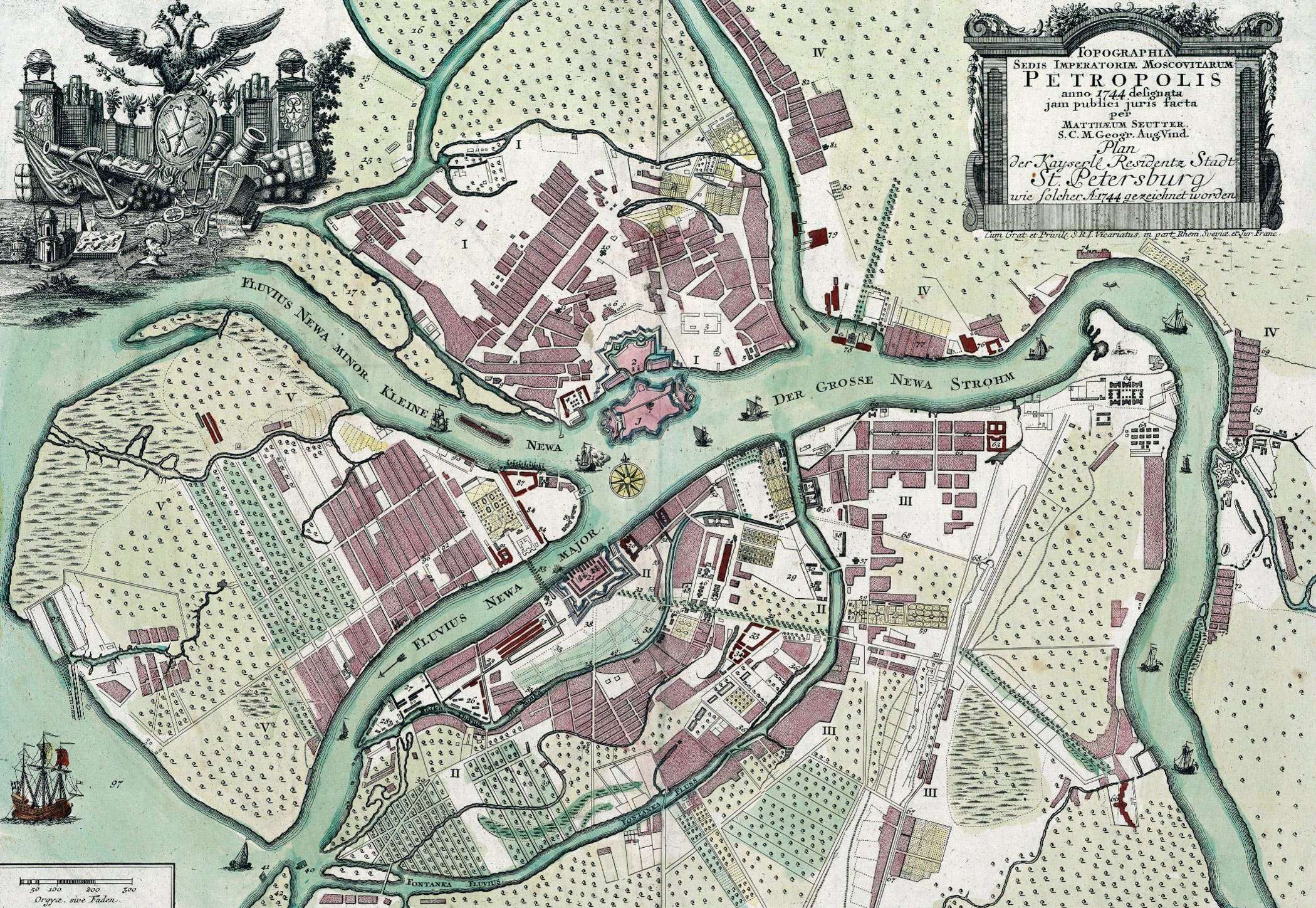
English: Map of St. Petersburg compiled, in 1744, by Matthias Souter Русский: Карта Санкт-Петербурга составленная в 1744 г. Маттиас Сойтер |
| Datum | |
| Izvor | http://www.spbin.ru/maps/map_stoyter_1744.htm |
| Autor | Маттиас Сойтер |
Licenciranje
|
This work is in the public domain in its country of origin and other countries and areas where the copyright term is the author's life plus 100 years or fewer. | |
| Ova datoteka je identificirana kao slobodna od poznatih ograničenja po zakonu o autorskim pravima, uključujući sva povezana i srodna prava. | |
Historija datoteke
Kliknite na datum/vrijeme da vidite verziju datoteke iz tog vremena.
| Datum/vrijeme | Smanjeni pregled | Dimenzije | Korisnik | Komentar | |
|---|---|---|---|---|---|
| trenutno | 09:47, 25 maj 2010 | | 2.100 × 1.448 (741 KB) | Peterburg23 | == Summary == {{Information |Description=Карта Санкт-Петербурга составленная в 1744 г. Маттиас Сойтер |Source=http://www.spbin.ru/maps/map_stoyter_1744.htm |Date=1744 |Author=Маттиас Сойтер |Perm |
Upotreba datoteke
Nema stranica koje koriste ovu datoteku.
Globalna upotreba datoteke
Sljedeći wikiji koriste ovu datoteku:
- Upotreba na azb.wikipedia.org
- Upotreba na en.wikipedia.org
- Upotreba na gl.wikipedia.org
- Upotreba na id.wikipedia.org
- Upotreba na io.wikipedia.org
- Upotreba na mt.wikipedia.org
- Upotreba na pl.wikipedia.org
- Upotreba na sl.wikipedia.org
- Upotreba na ta.wikipedia.org
- Upotreba na te.wikipedia.org
- Upotreba na zh.wikipedia.org