
Datoteka:Boka oldmap.gif

Izvorna datoteka (800 × 903 piksela, veličina datoteke: 101 KB, MIME tip: image/gif)
| Ova datoteka je s Wikimedia Commonsa. Opis s njene stranice opisa datoteke prikazan je ispod. Commons je skladište slobodnih medija i datoteka za sve projekte fondacije Wikimedia. Možete i Vi pomoći. |
Sažetak
| Opis |
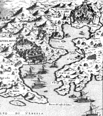
English: An old 16th century map of Kotor bay, Montenegro
Deutsch: Historische Karte der Bucht von Kotor: Gravur aus dem 16 Jh. mit den Handelsstädten der Bucht von Kotor |
| Datum | 16 century |
| Izvor | English Wikipedia / National Archive of Kotor, Montenegro |
| Autor | ? (uploaded by User:Orjen) |
Licenciranje
|
This work is in the public domain in its country of origin and other countries and areas where the copyright term is the author's life plus 70 years or fewer.
| |
| Ova datoteka je identificirana kao slobodna od poznatih ograničenja po zakonu o autorskim pravima, uključujući sva povezana i srodna prava. | |
Historija datoteke
Kliknite na datum/vrijeme da vidite verziju datoteke iz tog vremena.
| Datum/vrijeme | Smanjeni pregled | Dimenzije | Korisnik | Komentar | |
|---|---|---|---|---|---|
| trenutno | 17:06, 21 novembar 2013 | | 800 × 903 (101 KB) | DIREKTOR | Tone |
| 15:50, 26 maj 2006 |  | 800 × 903 (101 KB) | Epiq | {{Information |Description=An old 16th century map of Kotor bay, Montenegro |Source=English Wikipedia |Date=16th century |Author=? (uploaded by User:Orjen) |Permission= |other_versions= }} Category:Maps of Montenegro |
Upotreba datoteke
Sljedeća stranica koristi ovu datoteku:
Globalna upotreba datoteke
Sljedeći wikiji koriste ovu datoteku:
- Upotreba na ast.wikipedia.org
- Upotreba na bg.wikipedia.org
- Upotreba na de.wikipedia.org
- Upotreba na el.wikipedia.org
- Upotreba na en.wikipedia.org
- Upotreba na es.wikipedia.org
- Upotreba na fi.wikipedia.org
- Upotreba na fr.wikipedia.org
- Upotreba na hr.wikipedia.org
- Upotreba na it.wikipedia.org
- Upotreba na ja.wikipedia.org
- Upotreba na ka.wikipedia.org
- Upotreba na pt.wikipedia.org
- Upotreba na ru.wikipedia.org
- Upotreba na sh.wikipedia.org
- Upotreba na simple.wikipedia.org
- Upotreba na sq.wikipedia.org
- Upotreba na sr.wikipedia.org
- Upotreba na tr.wikipedia.org
- Upotreba na uk.wikipedia.org