
Datoteka:Caucasus region 1994.jpg

Veličina ovog prikaza: 782 × 600 piksela. Ostale rezolucije: 313 × 240 piksela | 626 × 480 piksela | 1.002 × 768 piksela | 1.280 × 982 piksela | 2.560 × 1.963 piksela | 3.119 × 2.392 piksela.
Izvorna datoteka (3.119 × 2.392 piksela, veličina datoteke: 1,18 MB, MIME tip: image/jpeg)
| Ova datoteka je s Wikimedia Commonsa. Opis s njene stranice opisa datoteke prikazan je ispod. Commons je skladište slobodnih medija i datoteka za sve projekte fondacije Wikimedia. Možete i Vi pomoći. |
| Opis |
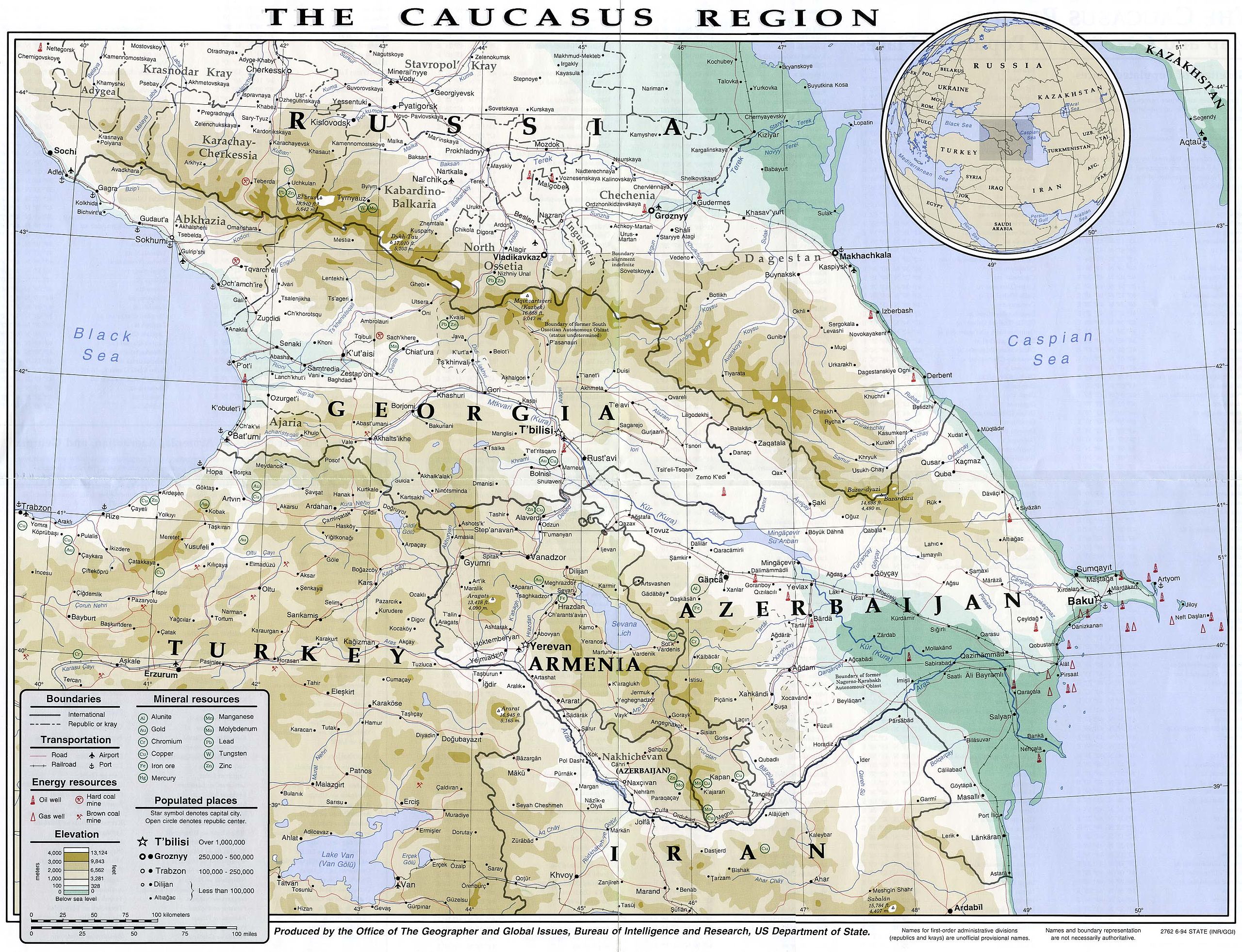
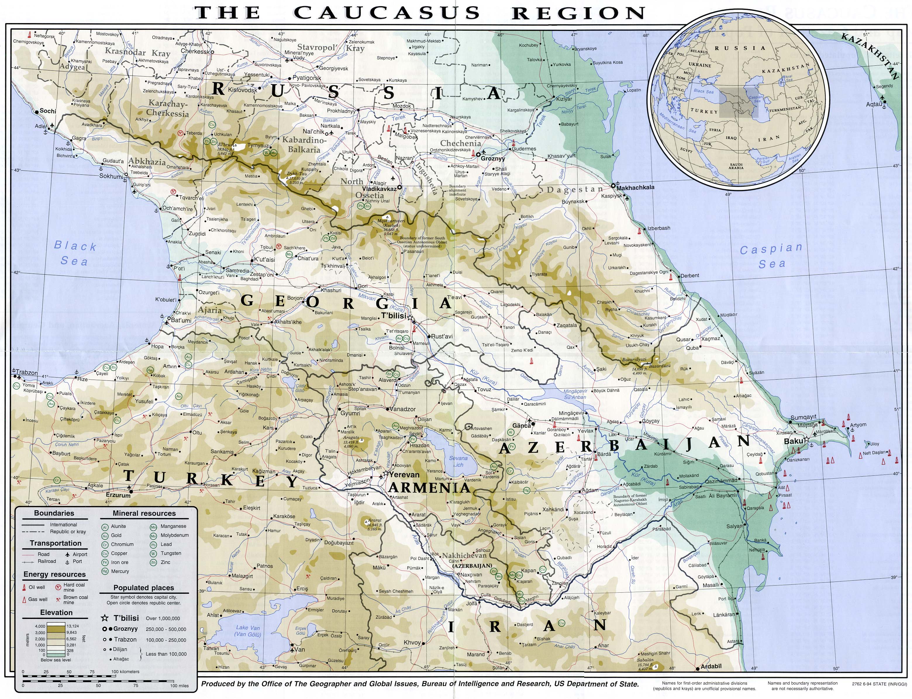
English: Map of the Caucasus region in 1994
Français : Carte du Caucase en 1994 |
|||
| Datum | ||||
| Izvor | University of Texas Library | |||
| Autor | CIA | |||
| Dopuštenje (Naknadno korištenje ove datoteke) |
|
|||
| Ostale verzije |


Historija datoteke
Kliknite na datum/vrijeme da vidite verziju datoteke iz tog vremena.
| Datum/vrijeme | Smanjeni pregled | Dimenzije | Korisnik | Komentar | |
|---|---|---|---|---|---|
| trenutno | 16:49, 16 juli 2007 | | 3.119 × 2.392 (1,18 MB) | Pmx | {{Information |Description= {{en|Map of the Caucasus region in 1994}} {{fr|Carte du Caucase en 1994}} |Source=University of Texas Library [http://www.lib.utexas.edu/maps/commonwealth/caucasus_region_1994.jpg] |Date=1994 |Author=CIA |Permission=Public doma |
Upotreba datoteke
Sljedeća stranica koristi ovu datoteku:
Globalna upotreba datoteke
Sljedeći wikiji koriste ovu datoteku:
- Upotreba na ar.wikipedia.org
- Upotreba na arz.wikipedia.org
- Upotreba na ast.wikipedia.org
- Upotreba na azb.wikipedia.org
- Upotreba na az.wikipedia.org
- Upotreba na ba.wikipedia.org
- Upotreba na bg.wikipedia.org
- Upotreba na bh.wikipedia.org
- Upotreba na ca.wikipedia.org
- Upotreba na de.wikivoyage.org
- Upotreba na en.wikipedia.org
- Upotreba na eo.wikipedia.org
- Upotreba na eu.wikipedia.org
- Upotreba na fr.wikipedia.org
- Upotreba na ga.wikipedia.org
- Upotreba na he.wikipedia.org
- Upotreba na hif.wikipedia.org
- Upotreba na hr.wikipedia.org
- Upotreba na hu.wikipedia.org
- Upotreba na id.wikipedia.org
- Upotreba na it.wikipedia.org
- Upotreba na it.wikivoyage.org
- Upotreba na kk.wikipedia.org
- Upotreba na ko.wikipedia.org
- Upotreba na ku.wikipedia.org
- Upotreba na ml.wikipedia.org
- Upotreba na ms.wikipedia.org
- Upotreba na pnb.wikipedia.org
- Upotreba na pt.wikipedia.org
- Upotreba na ro.wikipedia.org
- Upotreba na sl.wikipedia.org
- Upotreba na so.wikipedia.org
- Upotreba na su.wikipedia.org
- Upotreba na sv.wikivoyage.org
- Upotreba na ta.wikipedia.org
- Upotreba na tg.wikipedia.org
- Upotreba na th.wikipedia.org
- Upotreba na tl.wikipedia.org
Pogledajte globalne upotrebe ove datoteke.