
Datoteka:Map to show the Limits of Kuwait and Adjacent Country (1913).jpg

Veličina ovog prikaza: 614 × 599 piksela. Ostale rezolucije: 246 × 240 piksela | 492 × 480 piksela | 787 × 768 piksela | 1.050 × 1.024 piksela | 2.099 × 2.048 piksela | 3.457 × 3.373 piksela.
Izvorna datoteka (3.457 × 3.373 piksela, veličina datoteke: 1,13 MB, MIME tip: image/jpeg)
| Ova datoteka je s Wikimedia Commonsa. Opis s njene stranice opisa datoteke prikazan je ispod. Commons je skladište slobodnih medija i datoteka za sve projekte fondacije Wikimedia. Možete i Vi pomoći. |
.jpg)
Sažetak
| Opis |
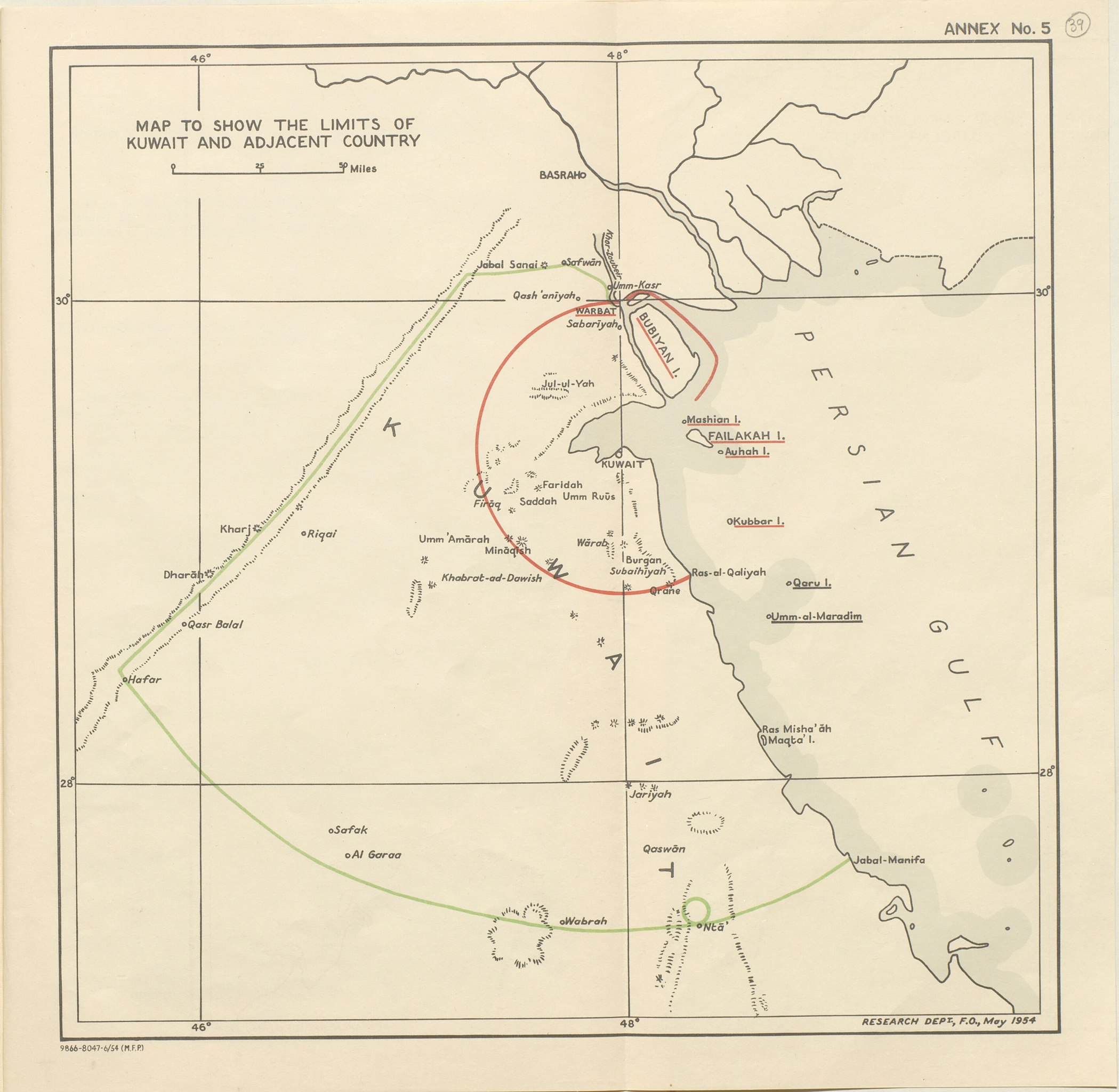
English: Map of the inner and outer zones of diminishing Kuwaiti Authority (Red Line and Green Line) defined by the 1913 Anglo-Ottoman Convention [1] |
| Datum | 1913? 1954? |
| Izvor | https://www.qdl.qa/en/archive/81055/vdc_100023550810.0x000050 |
| Autor | British Government |
Licenciranje
This work created by the United Kingdom Government is in the public domain.
This is because it is one of the following:
HMSO has declared that the expiry of Crown Copyrights applies worldwide (ref: HMSO Email Reply)
|
 |
Historija datoteke
Kliknite na datum/vrijeme da vidite verziju datoteke iz tog vremena.
| Datum/vrijeme | Smanjeni pregled | Dimenzije | Korisnik | Komentar | |
|---|---|---|---|---|---|
| trenutno | 14:37, 26 juli 2018 | | 3.457 × 3.373 (1,13 MB) | Ratzer | Cropped 4 % horizontally, 6 % vertically using CropTool with precise mode. |
| 12:02, 26 juli 2018 |  | 3.611 × 3.600 (1,31 MB) | Ratzer | User created page with UploadWizard |
Upotreba datoteke
Sljedeća stranica koristi ovu datoteku:
Globalna upotreba datoteke
Sljedeći wikiji koriste ovu datoteku:
- Upotreba na ar.wikipedia.org
- Upotreba na en.wikipedia.org
- Upotreba na fa.wikipedia.org
- Upotreba na he.wikipedia.org
- Upotreba na hr.wikipedia.org
- Upotreba na id.wikipedia.org
- Upotreba na it.wikipedia.org
- Upotreba na ja.wikipedia.org
- Upotreba na mt.wikipedia.org
- Upotreba na nl.wikipedia.org
- Upotreba na ru.wikipedia.org
- Upotreba na uk.wikipedia.org
- Upotreba na www.wikidata.org
.jpg)